Puzzle Directions: Click on a puzzle piece and drag it where you want it. When you connect two pieces correctly, they will join together. Mix up the pieces again. View finished map in pop-up window. |
|
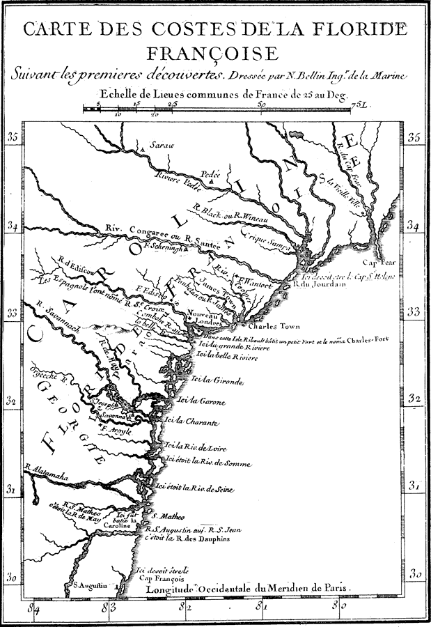
Title: Map of French Florida Colony
Projection:
Source Bounding Coordinates:
W: -85 E: -78 N: 36 S: 29 |
| | Description: Map shows the French governed colonies in Florida and easther U.S. during 1562 C.E. and through 1565 C.E. Shows all major rivers during this period in history.
Source: Woodbury Lowery, The Spanish Settlements within the Present Limits of the United States: Florida (New York , NY: G. P. Putnam's Son , 1911) 34
Map Credit: Courtesy the private collection of Roy Winkelman |
| |
|