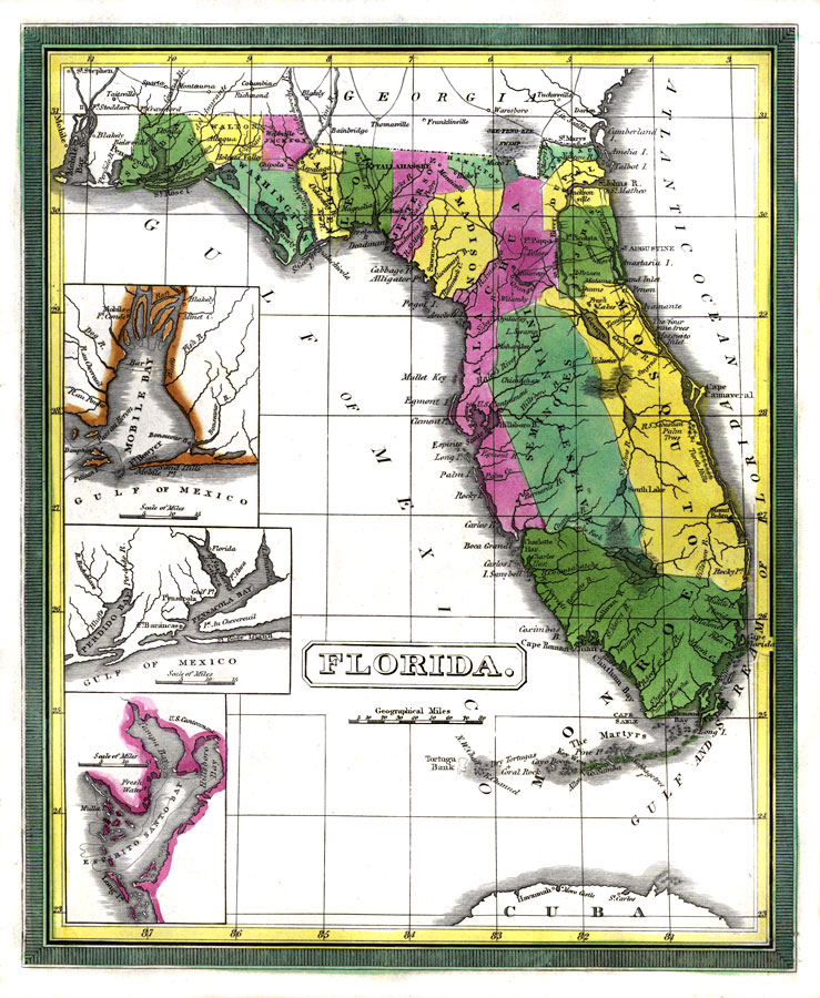
Description: Digitization provided by the USF Libraries Digitization Center. Rare Maps. This map of Florida was originally published in William Darby's Memoir on the geography and natural and civil history of Florida. This map shows the counties circa 1834. Alachua county spans from present day Baker county to Sarasota county. Mosquito county does not exist any longer, but on this map it encompasses the east coast from present day Flagler county south through Broward county. This map also shows the Seminole Indian territory which includes some of the central counties. Prime meridians: Washington and London. Includes insets showing Mobile Bay, Pensacola Bay and Espirito Santo Bay (this includes present day Tampa Bay). Measurements.Dimensions: 23.5 x 28.5 cm.
Source: William Darby, Memoir on the geography and natural and civil history of Florida (Philadelphia, PA: Thomas H. Palmer, 1834)
Map Credit: Courtesy of the Special Collections Department, University of South Florida. |
|