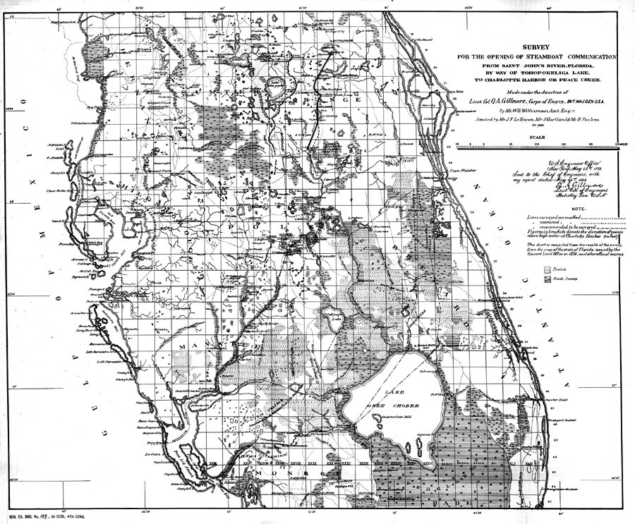
Title: Steamboat communication from Saint John's River, Fla., by way of Tohopokeliga Lake, to Charlotte Harbor or Peace Creek
Projection: Unknown
Source Bounding Coordinates:
W: E: N: S: |
| | Description: Digitization provided by the USF Libraries Digitization Center. Rare Maps. This map covers central peninsular Florida between Sanford and Charlotte Harbor. The map shows various proposed steamship routes between the train depot on Lake Tohopokeliga to Boca Grande at the mouth of Charlotte Harbor. It shows inland waters, impassable marshes and swamps, cities and towns, railroads and roads. Several Indian villages, U.S. Army forts, military campaign routes and battle sites from the Seminole war period are shown. Section Township Range (STR) based on the Tallahassee Prime Meridian and Tallahassee Base Line is shown. Measurement dimensions: 41 x 59 cm.
Source: W. G. Williamson and Q. A. Gillmore, (Washington, DC: United States Army Corps of Engineers, 1882)
Map Credit: Courtesy of the Special Collections Department, University of South Florida. |
| |
| FL Maps > Region > 1880-1899 > Steamboat communication from Saint John's River, Fla., by way of Tohopokeliga Lake, to Charlotte Harbor or Peace Creek, 1882 | |
|