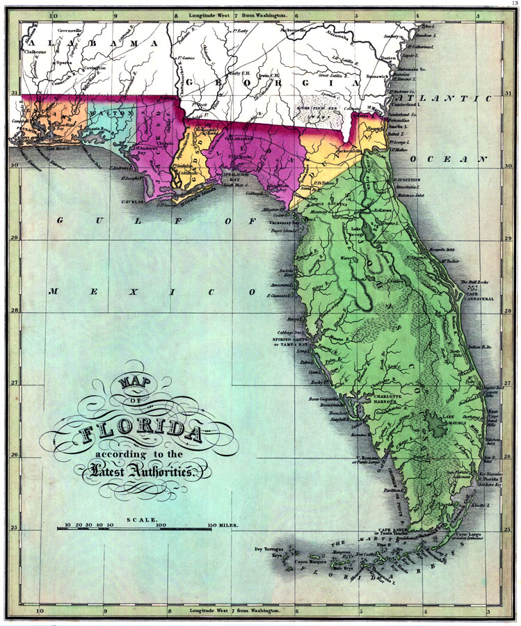
Description: Digitization provided by the USF Libraries Digitization Center. Rare Maps. This is a map of Florida showing the counties, cities and towns, inland waters, railroads, etc, circa 1827. Measurements.Dimensions: 29 x 25 cm. Measurements.Resolution: Scale [ca. 1:3,168,000].
Source: J. H. Young, (Philadelphia, PA: A. Finley, 1827)
Map Credit: Courtesy of the Special Collections Department, University of South Florida. |
|