Maps Site map
  FL Maps > Florida County Hydrography Maps
Site Map  

  Record   26   to   50  of   67

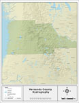
Florida Waterways: Hernando County , 2008
This map was created by FCIT and shows the waterways of Hernando County. All major rivers, streams, creeks, lakes, and swamps are labeled. This map features Crawford Creek, Tooke Lake, Withlacoochee River South, Hunters Lake, Indian Creek, Neff Lake,...

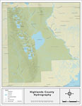
Florida Waterways: Highlands County , 2008
This map was created by FCIT and shows the waterways of Highlands County. All major rivers, streams, creeks, lakes, and swamps are labeled. This map features Morgan Hole Creek, Arbuckle Creek, Carter Creek, Wildcat Branch, Arbuckle Branch, Oack Creek...

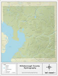
Florida Waterways: Hillsborough County , 2008
This map was created by FCIT and shows the waterways of Hillsborough County. All major rivers, streams, creeks, lakes, and swamps are labeled. This map features Keystone Lake, Rocky Creek, Sweetwater Creek, Fish Creek, Archie Creek, Curiosity Creek, ...

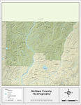
Florida Waterways: Holmes County , 2008
This map was created by FCIT and shows the waterways of Holmes County. All major rivers, streams, creeks, lakes, and swamps are labeled. This map features Corbett Branch, Holmes Creek, Wrights Creek, Texas Branch, Tenmile Creek, Titi Branch, Limeston...

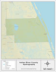
Florida Waterways: Indian River County , 2008
This map was created by FCIT and shows the waterways of Indian River County. All major rivers, streams, creeks, lakes, and swamps are labeled. This map features Main Canal, Indian River, Saint Sebatian River, Blue Cypress Lake, and Blue Cypress Creek...

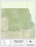
Florida Waterways: Jackson County , 2008
This map was created by FCIT and shows the waterways of Jackson County. All major rivers, streams, creeks, lakes, and swamps are labeled. This map features Little Creek, Holmes Creek, Gum Creek, Minnow Creek, Dorman Branch, Spring Creek, Moulten Slou...

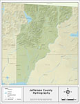
Florida Waterways: Jefferson County , 2008
This map was created by FCIT and shows the waterways of Jefferson County. All major rivers, streams, creeks, lakes, and swamps are labeled. This map features Wards Creek, Lake Miccosukee, Caney Creek, Drifton Branch, Mill Pond Creek, Morris Branch, C...

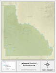
Florida Waterways: Lafayette County , 2008
This map was created by FCIT and shows the waterways of Lafayette County. All major rivers, streams, creeks, lakes, and swamps are labeled. This map features Bethel Creek, Suwannee River, Townsend Creek, Reedy Creek, Britt Creek, Owl Creek, Steinhatc...

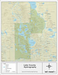
Florida Waterways: Lake County , 2008
This map was created by FCIT and shows the waterways of Lake County. All major rivers, streams, creeks, lakes, and swamps are labeled. This map features Juniper Creek, Lake George, Jumping Gully, Sellers Lake, Ninemile Creek, Lake Dexter, Get Out Cre...

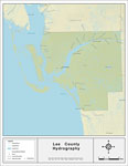
Florida Waterways: Lee County , 2008
This map was created by FCIT and shows the waterways of Lee County. All major rivers, streams, creeks, lakes, and swamps are labeled. This map features Spanish Creek, Bedman Creek, Cypress Creek, Hickey Creek, the Orange River, Billy Creek, Powell Cr...

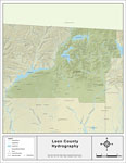
Florida Waterways: Leon County , 2008
This map was created by FCIT and shows the waterways of Leon County. All major rivers, streams, creeks, lakes, and swamps are labeled. This map features Lake Iamonia, Lake Jackson, the Ochlockonee River, Polk Creek, Harvey Creek, Lake Talquiin, Sweet...

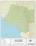
Florida Waterways: Levy County , 2008
This map was created by FCIT and shows the waterways of Levy County. All major rivers, streams, creeks, lakes, and swamps are labeled. This map features the Gopher River, the Suwannee River, the Waccasassa River, Chunky Pond, Magee Branch, Mule Creek...

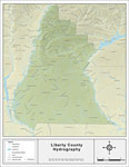
Florida Waterways: Liberty County , 2008
This map was created by FCIT and shows the waterways of Liberty County. All major rivers, streams, creeks, lakes, and swamps are labeled. This map features Short Creek, Rock Creek, Ferrell Branch, Mule Creek, Camp Creek, Carnigan Branch, Shanty Ford ...

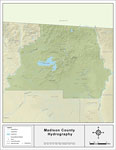
Florida Waterways: Madison County , 2008
This map was created by FCIT and shows the waterways of Madison County. All major rivers, streams, creeks, lakes, and swamps are labeled. This map features Withlacoochee River North, Suwannee River, North Creek, Hixtown Swamp, Sundown Creek, Alligato...

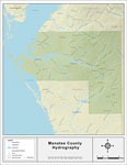
Florida Waterways: Manatee County , 2008
This map was created by FCIT and shows the waterways of Manatee County. All major rivers, streams, creeks, lakes, and swamps are labeled. This map features Curiosity Creek, Piney Point Creek, Frog Creek, Cabbage Slough, Cedar Drain, Manatee River, Wa...

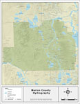
Florida Waterways: Marion County , 2008
This map was created by FCIT and shows the waterways of Marion County. All major rivers, streams, creeks, lakes, and swamps are labeled. This map features Orange Creek, Black Sink Prairie, Mill Creek, Oklawaha Lake, Ledwith Lake, Silver River, Gooski...

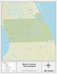
Florida Waterways: Martin County , 2008
This map was created by FCIT and shows the waterways of Martin County. All major rivers, streams, creeks, lakes, and swamps are labeled. This map features Bessy Creek, South Fork Saint Lucie River, Indian River, Warmer Creek, North Fork Saint Lucie R...

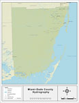
Florida Waterways: Miami-Dade County , 2008
This map was created by FCIT and shows the waterways of Miami-Dade County. All major rivers, streams, creeks, lakes, and swamps are labeled. This map features Rookery Branch, The Everglades, Black Creek, West Lake, Cuthbert Lake, Seven Palm Lake, and...

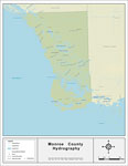
Florida Waterways: Monroe County , 2008
This map was created by FCIT and shows the waterways of Monroe County. All major rivers, streams, creeks, lakes, and swamps are labeled. This map features New River, Alligator Bay, Big Lostmans Bay, Rodgers River Bay, Rodgers River, Wood River, Broad...

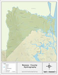
Florida Waterways: Nassau County , 2008
This map was created by FCIT and shows the waterways of Nassau County. All major rivers, streams, creeks, lakes, and swamps are labeled. This map features Upper Sister Creek, Lower Sister Creek, Bells River, Saint Marys River, Jolly River, Tiger Cree...

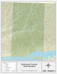
Florida Waterways: Okaloosa County , 2008
This map was created by FCIT and shows the waterways of Okaloosa County. All major rivers, streams, creeks, lakes, and swamps are labeled. This map features Cobb Branch, Rock Creek, Hurricane Creek, Bull Branch, Olive Branch, Cow Pen Branch, Mare Cre...

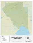
Florida Waterways: Okeechobee County , 2008
This map was created by FCIT and shows the waterways of Okeechobee County. All major rivers, streams, creeks, lakes, and swamps are labeled. This map features Lake Okeechobee, Lettuce Creek, Henry Creek, Nubbin Slough, Mosquito Creek, Popash Slough, ...

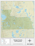
Florida Waterways: Orange County , 2008
This map was created by FCIT and shows the waterways of Orange County. All major rivers, streams, creeks, lakes, and swamps are labeled. This map features Econlockhatchee River, Lake Pickett, Buscombe Creek, Joshua Creek, Saint Johns River, Lake Cone...

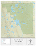
Florida Waterways: Osceola County , 2008
This map was created by FCIT and shows the waterways of Osceola County. All major rivers, streams, creeks, lakes, and swamps are labeled. This map features Bonnet Creek, Shingle Creek, Reedy Creek, Mill Slough,Jim Branch, East Lake Tohopekaliga, Toho...

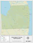
Florida Waterways: Palm Beach County , 2008
This map was created by FCIT and shows the waterways of Palm Beach County. All major rivers, streams, creeks, lakes, and swamps are labeled. This map features Loxahatchee River, West Palm Beach Canal, The Everglades, Lake Okeechobee, Miami Canal, Hil...

First Previous Next Last


  FL Maps > Florida County Hydrography Maps
Site Map  

Maps ETC is a part of the Educational Technology Clearinghouse
Produced by the Florida Center for Instructional Technology © 2007
College of Education , University of South Florida