|
|
|
| FL Maps > Region > 1950-1999 |
|
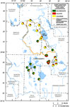
Concentrations of Bicarbonate, Sulfate, and Chloride in Spring Water from the Upper Floridan Aquifer of Ocala National Forest and Lake County,
1990 to 1999 |

|
Concentrations of Dissolved Oxygen in Groundwater from the Upper Floridan Aquifer of Ocala National Forest and Lake County,
1990 to 1999 |
|
Concentrations of Nitrate in Groundwater and Spring Water from the Upper Floridan Aquifer of Ocala National Forest and Lake County,
1990 to 1999 |

|
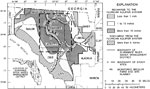
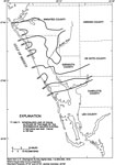
Cattle per Square Mile per County in South Florida,
1992 |
|
Water Budget Subbasins in Southeastern Florida,
1993 |
|
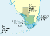
National Parks of South Florida,
1994 |

|
Everglades National Park,
1994 |
|
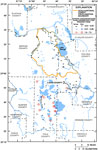
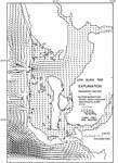
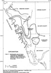
Rates of Recharge and Discharge to the Floridan Aquifer System in the Suwannee River Water Management District,
1995 |
|
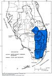
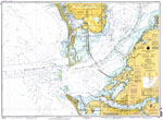
Tampa Bay, Southern Part,
1996 |
|
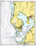
Tampa Bay and St. Joseph Sound,
1996 |
|
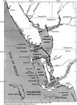
Charlotte Harbor Estuarine System and Subareas,
1996 |

|
Generalized Bottom Configuration of Charlotte Harbor,
1996 |

|
Continuous Particle and High Tide Particle Tracks in Charlotte Harbor,
1996 |

|
Floodtide Water Transport Vectors in Charlotte Harbor,
1996 |

|
Ebbtide Water Transport Vectors in Charlotte Harbor,
1996 |

|
High Slack Tide Water Transport Vectors in Charlotte Harbor,
1996 |
|
Low Slack Tide Water Transport Vectors in Charlotte Harbor,
1996 |

|
Generalized Thickness of the Surficial Aquifer System in Southwest Florida,
1996 |
|
Generalized Altitude of the Base of the Intermediate Aquifer System in Southwest Florida,
1996 |
|
Generalized Thickness and Extent of Permeable Zone 1 of the Intermediate Aquifer System in Southwest Florida,
1996 |
|
Generalized Thickness of Permeable Zone 2 of the Intermediate Aquifer System in Southwest Florida,
1996 |
|
Generalized Thickness of Permeable Zone 3 of the Intermediate Aquifer System in Southwest Florida,
1996 |

|
Generalized Thickness and Extent of the Venice Clay in Southwest Florida,
1996 |
|
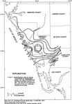
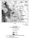
Generalized Topography of the Greater Orlando Metropolitan Area,
1996 |
|
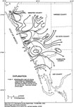
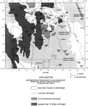
Distribution of Recharge and Discharge of the Upper Floridan Aquifer in the Greater Orlando Metropolitan Area,
1996 |
| First | Previous | Next | Last |
| FL Maps > Region > 1950-1999 |
Maps ETC
is a part of the
Educational Technology Clearinghouse
Produced by the
Florida Center for Instructional Technology
© 2007
College of Education
,
University of South Florida