|
|
|
| FL Maps > Region > before 1700 |
|
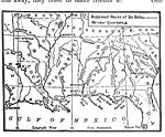
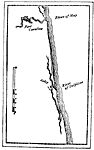
Route of De Soto,
1539 |
|
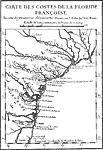
Map of French Florida Colony,
1562 |
|
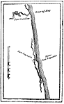
Old St. Augustine,
1565 |
|
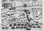
EXPVGNATIO CIVTATIS S. AV.,
1586 |
|
Old St. Augustine,
August 29, 1565 |
| FL Maps > Region > before 1700 |
Maps ETC
is a part of the
Educational Technology Clearinghouse
Produced by the
Florida Center for Instructional Technology
© 2007
College of Education
,
University of South Florida