Maps Site map
  FL Maps > County > Palm Beach
Site Map  

Palm Beach County Maps

Click on a thumbnail image to view a full size version of that map.

Palm Beach County is Florida's 47th county, established on April 30, 1909, from a segment of Dade County. It gains its name from the large amounts of coconut palm trees found on Atlantic coast of Florida. West Palm Beach is the county seat.

For earlier maps of this area, visit the Dade County map gallery.


  Record   26   to   37  of   37

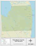
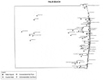
Florida Waterways: Palm Beach County , 2008
This map was created by FCIT and shows the waterways of Palm Beach County. All major rivers, streams, creeks, lakes, and swamps are labeled. This map features Loxahatchee River, West Palm Beach Canal, The Everglades, Lake Okeechobee, Miami Canal, Hil...

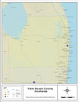
Sinkholes of Palm Beach County, Florida , 2008
This map was created by FCIT and represents reported sinkhole events in Palm Beach County based on data gathered by the Florida Geological Survey (FGS) and the Florida Department of Environmental Protection (FDEP). " This dataset represents a se...

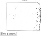
Florida Waterways: Palm Beach County Outline without Labels, 2008
This topographical map was created by FCIT and shows the waterways of Palm Beach County. All major rivers, streams, creeks, canals, bays and lakes are present, but not labeled. For a student activity sheet with directions for labeling the following: ...

Palm Beach "Abstract" Style Maps in 30 Styles, 2008
A collection of 30 Palm Beach County maps in a range of abstract graphic styles suitable for use in presentations and websites. Since the style is abstract, these maps can be used in projects on a wide variety of topics. Each of the maps is in the JP...

Palm Beach County "Fun" Maps in 30 Styles, 2008
A collection of 30 Palm Beach County maps in a crazy range of styles including blue jeans, chalkboards, pirate maps, coins, hearts, and even swimming pools. Use them as attention-getting slides in presentations or on websites. Each of the maps is in...

Florida Seagrass: Palm Beach, 2008
This topographical map was created by FCIT and shows the seagrass distribution for Palm Beach County. The green coloration depicts continuous seagrass while the yellow shows discontinuous seagrass. In addition to the seagrass, rivers, towns, and hig...

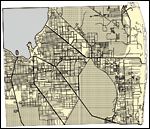
Palm Beach County Cities with Labels, 2009
This is a black and white city map of Palm Beach county, 2009. It shows the location with names of unincorporated cities/towns (black dot) such as Loxahatchee, incorporated cities/towns (circle with dot) such as Juno Beach, and the county seat (circl...

Palm Beach County Cities Outline, 2009
This is a black and white city outline map of Palm Beach county, 2009. It shows the location without names of unincorporated cities/towns (black dot), incorporated cities/towns (circle with dot), and the county seat (circle with star)....

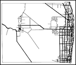
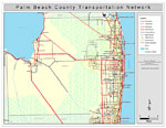
Palm Beach County Road Network- Black and White, 2009
This is a black and white road map of Palm Beach county, 2009. It shows the location of many roads, including US-27, US-1 and I-95. ...

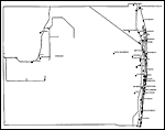
Palm Beach County Railway Network- Black and White, 2009
This is a black and white railroad map of Palm Beach county, 2009. It also shows location of cities and towns including West Palm Beach and Boca Raton....

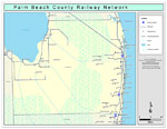
Palm Beach County Railway Network- Color, 2009
This is a color railroad map of Palm Beach county, 2009. It also shows location of cities and towns including West Palm Beach and Boca Raton, inland water including rivers and lakes, and Amtrak stations....

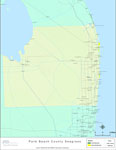
Palm Beach County Road Network- Color, 2009
This is a color road map of Palm Beach county, 2009. It shows the location of many roads including US-1 and I-95, cities and towns, and inland water....

First Previous


  FL Maps > County > Palm Beach
Site Map  

Maps ETC is a part of the Educational Technology Clearinghouse
Produced by the Florida Center for Instructional Technology © 2007
College of Education , University of South Florida