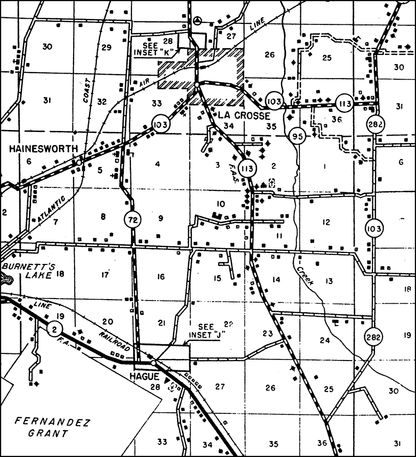
Description: This is a detailed map of the city La Crosse in Alachua County, Florida. Section Township Range (STR) is shown. This map shows state roads (103, 95, 113, 282 and 72), railroads, federal aid highways, surrounding towns, inland waters, corporate lines, cemeteries, intensive recreational areas, schools, tenant houses, churches, businesses, farm units and dwellings other than farms. Key to Florida Highway maps.
Source: , Florida State Road Department (, FL: , 1936)
Map Credit: Courtesy the private collection of Roy Winkelman. |
|