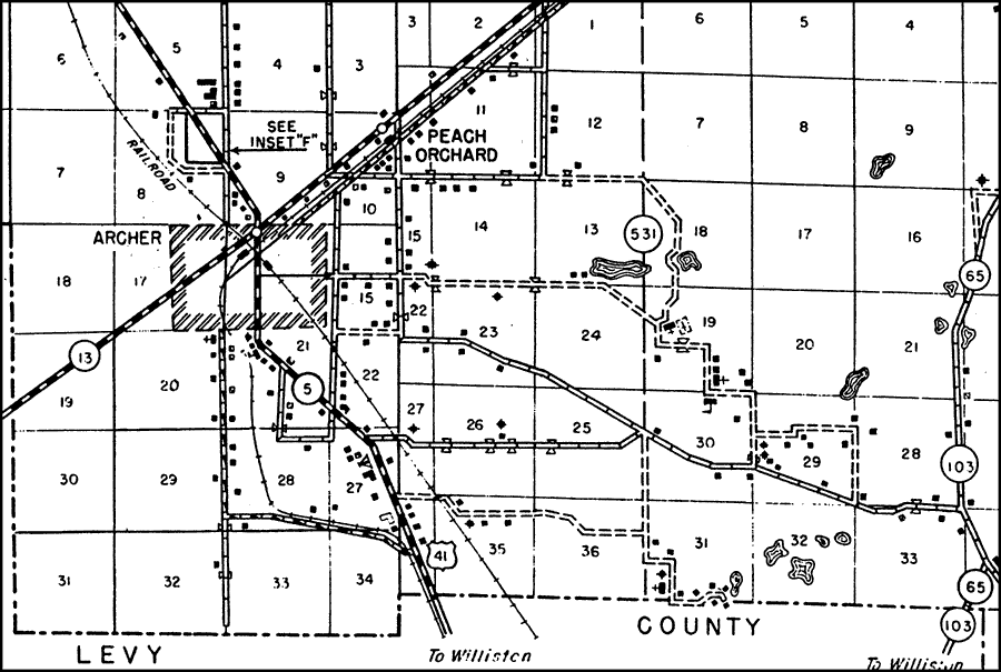
Description: This is a detailed map of the city Peach Orchard in Alachua County, Florida. Section Township Range (STR) is shown. This map shows state roads (13, 531, 103 and 65), US Highways (41), railroads, surrounding towns, county border, tourist camps, federal aid highways, federal aid secondary highways, churches, schools, turpentine still, cemeteries, corporate lines, businesses, cattle guards, tenant houses, farm units and dwellings other than farms. Key to Florida Highway maps.
Source: , Florida State Road Department (, FL: , 1936)
Map Credit: Courtesy the private collection of Roy Winkelman. |
|