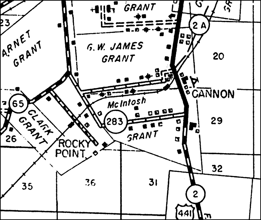
Description: This is a detailed map of the city Rocky Point in Alachua County, Florida. Section Township Range (STR) is shown. This map shows state roads (283, 2 A, 2 and 65), US Highways (441), railroads, surrounding towns, tourist camp, churches, schools, cemeteries, turpentine still, post office, businesses, tenant houses, farm units and dwellings other than farms. Key to Florida Highway maps.
Source: , Florida State Road Department (, FL: , 1936)
Map Credit: Courtesy the private collection of Roy Winkelman. |
|