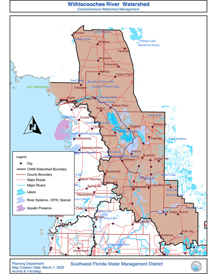
Description: This is a map from the Southwest Florida Watershed Management District or SWFWMD of the Withlacoochee River watershed, created on March 7, 2002. This map shows the Comprehensive Watershed Management or CWM boundary, outstanding Florida waters (OFW, Special) highlighted in lavender, and aquatic preserves in green. It also shows surrounding cities, major roads, rivers and lakes and county boundaries.
Place Names: 2000-, Withlacoochee River, �Orange Lake, �Hawthorn Prairie, �Bronson, �Williston, �Fairfield, �Morristown, �Cotton Plant, �Remeo, �Fellowship, �Rainbow River, �Stokes Ferry, �Wildwood, �Coleman, �Lacoochee, �Homosassa, �Rock Ridge, �Poyner, �Bay Lake, �Clay, �Bushnell, �Center Hill, �Nobleton, �Brooksville, �Spring Hill, �Zephyrhills, �Providence, �Polk City,
ISO Topic Categories: boundaries, �inlandWaters, �transportation, �geoscientificInformation
Keywords: Withlacoochee River Watershed- Comprehensive Watershed Management, physical, �political, �transportation, �hydrological, �watershed, �kwatershed, physical features, county borders, roads, boundaries, �inlandWaters, �transportation, �geoscientificInformation, Unknown,March 7, 2002
Source: Southwest Florida Water Management District, (Brooksville, FL: Southwest Florida Water Management District, March 7, 2002)
Map Credit: Courtesy of the Southwest Florida Water Management District |
|