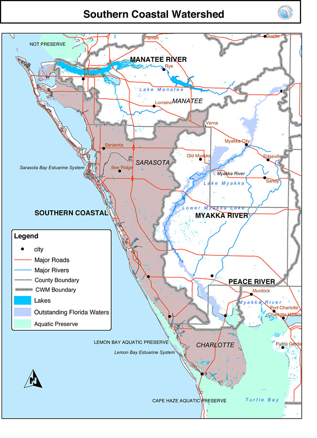
Description: This is a map from the Southwest Florida Watershed Management District or SWFWMD of the Southern Coastal watershed. This map shows the Comprehensive Watershed Management or CWM boundary (thick gray line), outstanding Florida waters highlighted in lavender, and aquatic preserves in green. It also shows surrounding cities, major roads, rivers and lakes and county boundaries.
Place Names: 2000-, Manatee River, �Manatee, �Myakka River, �Peace River, �Charlotte, �Turtle Bay, �Sarasota, �Bee Ridge, �Old Myakka, �Myakka City, �Bradenton, �Palmetto, �Sarasota Bay Estuarine System, �Lemon Bay Aquatic Preserve, �Cape Haze Aquatic Preserve
ISO Topic Categories: boundaries, �inlandWaters, �transportation, �geoscientificInformation
Keywords: Southern Coastal Watershed, physical, �political, �transportation, �hydrological, �watershed, �kwatershed, physical features, county borders, roads, boundaries, �inlandWaters, �transportation, �geoscientificInformation, Unknown,n. d.
Source: Southwest Florida Water Management District, (Brooksville, FL: Southwest Florida Water Management District, n. d.)
Map Credit: Courtesy of the Southwest Florida Water Management District |
|