Maps Site map
  FL Maps > State > before 1700
Site Map  

  Record   1   to   22  of   22

Distribution of the Barbarous Tribes East of the Mississippi, 1491
A map of the Native American families and groups in North America east of the Mississippi River circa 1491. The map shows Florida to be in the Maskoki or Southern Indian family, with the Seminole group predominately in peninsular Florida and the Cree...

Principle Indian Nations, 1500
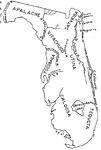
Map indicates the locations of certain Indian Tribes with in Florida's territory in the 1500's....

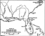
Routes of Narvaez, De Soto, and Ponce De Leon, 1513 to 1542
A map of Florida and the southern region of North America showing the routes of the Spanish explorers Narvaez in 1528, De Soto in 1539 to 1542, and Ponce De Leon in 1513. This map also shows the early Huguenot settlements of 1564, Saint Augustine, th...

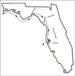
Route of Narvaez through Florida, 1528
A worksheet outline map showing the route of Panfilo de Narvaez through Florida....

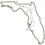
Route of de Soto through Florida, 1539
A worksheet outline map showing Hernando de Soto's route through Florida from his landing site south of the Tampa Bay northward....

Route of De Soto and De Moscoso, 1539 to 1543
A map showing the route of Hernando De Soto and Luis De Moscoso according to the findings of the U.S. De Soto Expedition Commission, 1939. Map shows Spanish place names along the route, and shows the route preferred by the commission along with poss...

Florida, 1562
Map shows all major rivers and lakes located in Florida during 1562 C.E. Shows all major cities and forts in Florida between the years of 1562 C.E. and 1574 C.E. ...

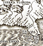
Americae sive qvartae orbis partis nova et exactissima descriptio , 1562
This detail is from the 1562 collaborative map by Diego Gutiérrez, a Spanish cartographer from Casa de la Contratación in Seville, and Hieronymous Cock, a noted engraver from Antwerp. The original map covers both North and South America, showing coas...

La Florida - Detail, 1584
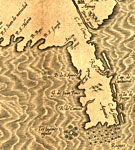
This is a detail from the map drawn of Florida in 1584 by Chaves. The area shown extends across the present-day Florida panhandle and peninsula, with relief shown pictorially. The map is hand drawn with the title in decorative cartouche, and the insc...

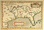
La Florida, 1584
This map drawn of Florida in 1584. The area shown extends across the present-day Southeastern United States, with relief shown pictorially. The map shows coastlines, rivers, mountains, and settlements. The map is hand drawn with the title in decorat...

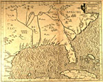
Florida et Apalche , 1597
A hand colored map of Florida and the Southeast Coast of North America, taken from from Wytfliet's Descriptiones Ptolemaicae Augmentum, siue Occidentis Notitia Brevi Commentario. (Louvain, Tijpis Iohannis Bogardi, 1597), the first atlas of America wh...

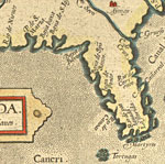
Florida et Apalche - Detail, 1597
A detail from the hand colored map of Florida and the Southeast Coast of North America, taken from from Wytfliet's Descriptiones Ptolemaicae Augmentum, siue Occidentis Notitia Brevi Commentario. (Louvain, Tijpis Iohannis Bogardi, 1597), the first atl...

Indian Tribes of the 16th Century, 1600
Map shows the locations of Indian Tribes in Florida during the 16th Century. Shows major lakes, rivers, St. Augustine and Ft. Caroline...

Early Indian Tribes East of the Mississippi, 1600
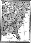
A map of the three major Native American confederacies and tribes in North America east of the Mississippi River at the time of the early explorers. The map shows Florida to be in the Mobilian confederacy, with the Seminole tribe predominately in pen...

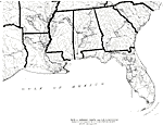
French, English, Dutch, Swedish and Spanish Provinces , 1600
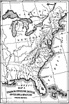
A map of eastern North America showing the provinces claimed by various European countries. Spanish Florida is shown stretching from the mouth of the Saint Mary River westward to the Mississippi River to a point north of the Arkansas River near prese...

Map of Florida, 1606
Map shows Florida's coast and everything that was located on it up the year 1606 ...

Map of the Indian Families, 1650
A map of the Native American families and groups in North America east of the Mississippi River as located in 1650. The map shows Florida to be in the Mobilian family, with the Seminole group predominately in peninsular Florida and the Muscogee or Cr...

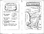
Florida, 1679
Digitization provided by the USF Libraries Digitization Center. Rare Maps. This is a map of Florida which includes present day southeast U. S., circa 1679. The text on the map states "Florida is divided into five parts: The Peninsula, The Spanis...

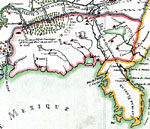
Detail - Franquelin's map of Louisiana, 1684
This detail is from a 1896 reproduction of a map originally printed in 1684 relating to a Jesuit Relationships manuscript. As noted by the Library of Congres, "Reduced facsimile of MS. copy (made in Paris for Francis Parkman), now in the Library...

Detail - Franquelin's map of Louisiana, 1684
This detail is from a 1896 reproduction of a map originally printed in 1684 relating to a Jesuit Relationships manuscript. As noted by the Library of Congres, "Reduced facsimile of MS. copy (made in Paris for Francis Parkman), now in the Library...

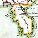
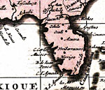
America septentrionalis in suas praecipuas parte divisa, ad usum serenissimi Burgundiae ducis, 1694
A detail from the 1694 hand colored map presented to Monseigneur el Duc de Bourgogne showing peninsular Florida. ...

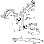
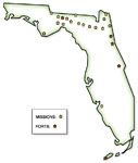
Location of Spanish missions and forts in Florida, Before 1700
A worksheet outline map showing the locations of Spanish missions and forts in Florida....


  FL Maps > State > before 1700
Site Map  

Maps ETC is a part of the Educational Technology Clearinghouse
Produced by the Florida Center for Instructional Technology © 2007
College of Education , University of South Florida