Maps Site map
  FL Maps > Region > 2000-
Site Map  

  Record   126   to   150  of   217

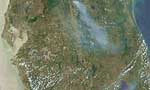
Springs Coast Watershed Aerial Topographic Mapping, February 23, 2001
This is a map from the Southwest Florida Watershed Management District or SWFWMD of the Springs Coast watershed Aerial Topographic Mapping, created on February 23, 2001. The following mapping areas are shown on the key: Mapping Under Contract (yellow...

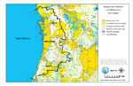
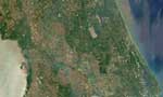
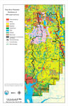
Springs Coast Watershed Distribution of Natural Systems - 1995, February 23, 2001
This is a map from the Southwest Florida Watershed Management District or SWFWMD of the Springs Coast watershed distribution of natural systems from 1995, created on February 23, 2001. The following natural system classifications are shown by color: ...

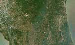
Springs Coast Watershed Historic Vegetation, February 23, 2001
This is a map from the Southwest Florida Watershed Management District or SWFWMD of the Springs Coast watershed historic vegetation, created on February 23, 2001. The following historic vegetation classifications are shown by color: Pine Flatwoods (l...

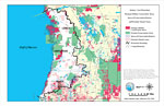
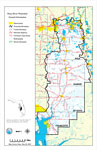
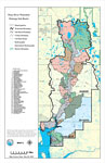
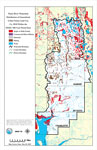
Springs Coast Watershed Distribution of Conservation Lands, February 23, 2001
This is a map from the Southwest Florida Watershed Management District or SWFWMD of the Springs Coast watershed distribution of conservation lands, created on February 23, 2001. The following ownership classifications are shown by color: Federal Owne...

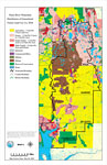
Springs Coast Watershed Strategic Habitat Conservation Areas, Areas of Conservation Interest, and Potential Natural Areas, February 23, 2001
This is a map from the Southwest Florida Watershed Management District or SWFWMD of the Springs Coast watershed strategic habitat conservation area, areas of conservation interest and potential natural areas, created on February 23, 2001. The followi...

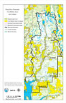
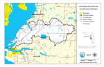
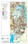
Springs Coast Watershed Core Habitat Areas and Linkages, February 23, 2001
This is a map from the Southwest Florida Watershed Management District or SWFWMD of the Springs Coast watershed core habitat areas and linkages, created on February 23, 2001. The following is shown on the key: Natural Land Cover (light green), Core H...

Peace River Watershed Core Habitat Areas and Linkages, June 19, 2001
This is a map from the Southwest Florida Watershed Management District or SWFWMD of the Peace River watershed core habitat areas and linkages, created on June 19, 2001. The following is shown on the key: Natural Land Cover (light green), Core Habitat...

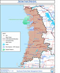
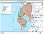
Springs Coast Watershed- Comprehensive Watershed Management, March 7, 2002
This is a map from the Southwest Florida Watershed Management District or SWFWMD of the Springs Coast watershed, created on March 7, 2002. This map shows the Comprehensive Watershed Management or CWM boundary, outstanding Florida waters (OFW, Special...

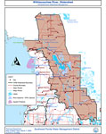
Withlacoochee River Watershed- Comprehensive Watershed Management, March 7, 2002
This is a map from the Southwest Florida Watershed Management District or SWFWMD of the Withlacoochee River watershed, created on March 7, 2002. This map shows the Comprehensive Watershed Management or CWM boundary, outstanding Florida waters (OFW, S...

Tampa Bay/Anclote River Watershed- Comprehensive Watershed Management, March 7, 2002
This is a map from the Southwest Florida Watershed Management District or SWFWMD of the Tampa Bay/Anclote River watershed, created on March 7, 2002. This map shows the Comprehensive Watershed Management or CWM boundary, outstanding Florida waters (OF...

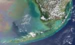
Florida Fires- Detail of the Florida Keys, May 19, 2001
This is a detail image of the Florida Keys from the satellite image of Florida showing the fires on May 19, 2001. According to news sources, there were nine large fires burning in Florida on May 19 and as many as fifteen fires burning on May 21....

Florida Fires- Detail of South Florida, May 19, 2001
This is a detail image of South Florida from the satellite image of Florida showing the fires on May 19, 2001. According to news sources, there were nine large fires burning in Florida on May 19 and as many as fifteen fires burning on May 21....

Florida Fires- Detail of South Central Florida, May 19, 2001
This is a detail image of South Central Florida from the satellite image of Florida showing the fires on May 19, 2001. According to news sources, there were nine large fires burning in Florida on May 19 and as many as fifteen fires burning on May 21....

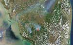
Florida Fires- Detail of North Central Florida, May 19, 2001
This is a detail image of North Central Florida from the satellite image of Florida showing the fires on May 19, 2001. According to news sources, there were nine large fires burning in Florida on May 19 and as many as fifteen fires burning on May 21....

Florida Fires- Detail of North Florida, May 19, 2001
This is a detail image of North Florida from the satellite image of Florida showing the fires on May 19, 2001. According to news sources, there were nine large fires burning in Florida on May 19 and as many as fifteen fires burning on May 21....

Peace River Watershed General Information, May 2, 2001
This is a map from the Southwest Florida Watershed Management District or SWFWMD of the Peace River watershed general location information created on May 2, 2001. This map shows the Watershed Management boundary shown by the thick black line, distric...

Peace River Watershed Drainage Sub-Basins, May 2, 2001
This is a map from the Southwest Florida Watershed Management District or SWFWMD of the Peace River watershed drainage sub-basins, created on May 2, 2001. Each sub-basin is numbered shown to the left of the map. The sub-basins are also separated by c...

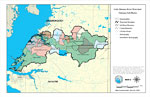
Little Manatee River Watershed General Location Information- Map 1, May 3, 2001
This is a map from the Southwest Florida Watershed Management District or SWFWMD of the Little Manatee River watershed general location information created on May 3, 2001. This map shows the Watershed Management boundary shown by the thick black line...

Little Manatee River Watershed Drainage Sub-Basins- Map 2, May 3, 2001
This is a map from the Southwest Florida Watershed Management District or SWFWMD of the Little Manatee River watershed drainage sub basins created on May 3, 2001. Each sub basin is shown with the names and separated by colors. This map shows the Wate...

Little Manatee Watershed Distribution of 1995 Land Use/Cover- Map 3, May 3, 2001
This is a map from the Southwest Florida Watershed Management District or SWFWMD of the Little Manatee River watershed distribution of 1995 land use/cover created on May 3, 2001. This map shows the Watershed Management boundary shown by the thick bla...

Peace River Watershed Distribution of FEMA 100-Year Flood Zones, May 3, 2001
This is a map from the Southwest Florida Watershed Management District or SWFWMD of the Peace River watershed distribution of FEMA 100-year flood zones, created on May 3, 2001. Flood Zone A is shown in light teal and Flood Zone V (wave action) is sho...

Peace River Watershed Distribution of Generalized Urban Future Land Use, Ca. 2010 Within the FEMA 100-Year Flood Zone, May 3, 2001
This is a map from the Southwest Florida Watershed Management District or SWFWMD of the Peace River watershed distribution generalized urban future land use circa 2010 within the FEMA 100-year flood zone, created on May 3, 2001. The following urban l...

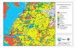
Peace River Watershed Distribution of 1995 Land Use/Cover, May 4, 2001
This is a map from the Southwest Florida Watershed Management District or SWFWMD of the Peace River watershed distribution of 1995 land use/cover, created on May 4, 2001. The watershed boundary is shown by a thick black line. Land use/cover classific...

Peace River Watershed Distribution of Generalized Future Land Use, Ca. 2010, May 4, 2001
This is a map from the Southwest Florida Watershed Management District or SWFWMD of the Peace River watershed distribution of generalized future land use, ca. 2010, created on May 4, 2001. This map shows the Watershed Management boundary shown by the...

Peace River Watershed Distribution of 1995 Agricultural Land Use/Cover, May 4, 2001
This is a map from the Southwest Florida Watershed Management District or SWFWMD of the Peace River watershed distribution of 1995 agricultural land use/cover, created on May 4, 2001. This map shows the Watershed Management boundary shown by the thic...

First Previous Next Last


  FL Maps > Region > 2000-
Site Map  

Maps ETC is a part of the Educational Technology Clearinghouse
Produced by the Florida Center for Instructional Technology © 2007
College of Education , University of South Florida