Maps Site map
  FL Maps > Florida County Hydrography Maps
Site Map  

  Record   1   to   25  of   67

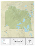
Florida Waterways: Alachua County , 2008
This map was created by FCIT and shows the waterways of Alachua County. All major rivers, streams, creeks, lakes, and swamps are labeled. This map details the Santa Fe River, Watermelon Pond, Little Monteocha Creek, Lake Altro, South Fork Black Creek...

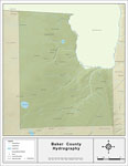
Florida Waterways: Baker County , 2008
This map was created by FCIT and shows the waterways of Baker County. All major rivers, streams, creeks, lakes, and swamps are labeled. This map details Cross Branch, Moccasin Creek, Little River, Okefenokee Swamp, Middle Prong Saint Marys River, Bil...

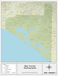
Florida Waterways: Bay County , 2008
This map was created by FCIT and shows the waterways of Bay County. All major rivers, streams, creeks, lakes, and swamps are labeled. This map pictures Goshum Branch, Branning Branch, Sweetwater Creek, Reedy Creek, Double Branch, Little Bear Creek, B...

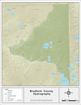
Florida Waterways: Bradford County , 2008
This map was created by FCIT and shows the waterways of Bradford County. All major rivers, streams, creeks, lakes, and swamps are labeled. This map features New River, Alligator Creek, Gum Creek, Sampson Lake, Hampton Lake, Santa Fe River, Santa Fe L...

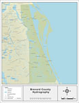
Florida Waterways: Brevard County , 2008
This map was created by FCIT and shows the waterways of Brevard County. All major rivers, streams, creeks, lakes, and swamps are labeled. This map features Buck Lake, Loughman Lake, South Lake, Saint Johns River, Indian River, Banana Creek, Banana Ri...

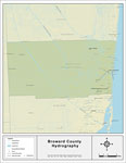
Florida Waterways: Broward County , 2008
This map was created by FCIT and shows the waterways of Broward County. All major rivers, streams, creeks, lakes, and swamps are labeled. This map features Tarpon River, New River, South Park New River, North New River Canal, Miami Canal, and the Eve...

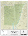
Florida Waterways: Calhoun County , 2008
This map was created by FCIT and shows the waterways of Calhoun County. All major rivers, streams, creeks, lakes, and swamps are labeled. This map features May Mill Creek, Hansford Branch, Ring Jaw Branch, Hollis Branch, Holliman Branch, Boardhead Br...

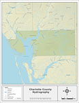
Florida Waterways: Charlotte County , 2008
This map was created by FCIT and shows the waterways of Charlotte County. All major rivers, streams, creeks, lakes, and swamps are labeled. This map features Rock Creek, Oyster Creek, Sam Knight Creek, Myakka River, Peace River, Lee Branch, Prairie C...

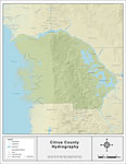
Florida Waterways: Citrus County , 2008
This map was created by FCIT and shows the waterways of Citrus County. All major rivers, streams, creeks, lakes, and swamps are labeled. This map features Tsala Apopka Lake, Withlacoochee River South, and Lake Rousseau....

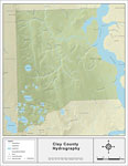
Florida Waterways: Clay County , 2008
This map was created by FCIT and shows the waterways of Clay County. All major rivers, streams, creeks, lakes, and swamps are labeled. This map features Ortega River, Saint Johns River, Lucy Branch, Peters Branch, North Prong Double Branch, Grog Bran...

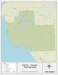
Florida Waterways: Collier County , 2008
This map was created by FCIT and shows the waterways of Collier County. All major rivers, streams, creeks, lakes, and swamps are labeled. This map features Lake Trafford, New River, Turner River, Left Hand Turner River, Barron River, Ferguson River, ...

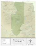
Florida Waterways: Columbia County , 2008
This map was created by FCIT and shows the waterways of Columbia County. All major rivers, streams, creeks, lakes, and swamps are labeled. This map features Okefenokee Swamp, Bay Creek, Suwannee River, Little Creek, Deep Creek, Little Branch, Caney F...

Florida Waterways: DeSoto County , 2008
This map was created by FCIT and shows the waterways of DeSoto County. All major rivers, streams, creeks, lakes, and swamps are labeled. This map features Brandy Branch, Horse Creek, Walker Branch, Mare Branch, Bear Branch, Sand Gully, Peace River, H...

Florida Waterways: Dixie County , 2008
This map was created by FCIT and shows the waterways of Dixie County. All major rivers, streams, creeks, lakes, and swamps are labeled. This map features Steinhatchee River, Eightmile Creek, Pine Log Creek, Rocky Creek, Buck Creek, Cow Creek, Little ...

Florida Waterways: Duval County , 2008
This map was created by FCIT and shows the waterways of Duval County. All major rivers, streams, creeks, lakes, and swamps are labeled. This map features Seaton Creek, Inconstation Creek, Deese Creek, Burton Creek, Nassau River, Bogey Branch, Dunn Cr...

Florida Waterways: Escambia County , 2008
This map was created by FCIT and shows the waterways of Escambia County. All major rivers, streams, creeks, lakes, and swamps are labeled. This map features Big Escambia Creek, Wiggins Branch, Pritchell Mill Branch, Canoe Creek, Mitchell Creek, Breas...

Florida Waterways: Flagler County , 2008
This map was created by FCIT and shows the waterways of Flagler County. All major rivers, streams, creeks, lakes, and swamps are labeled. This map features Pringle Branch, Pellicer Creek, Matanzas River, Crescent Lake, Black Branch, Little Black Bran...

Florida Waterways: Franklin County , 2008
This map was created by FCIT and shows the waterways of Franklin County. All major rivers, streams, creeks, lakes, and swamps are labeled. This map features the Ocklockonee River, the Crooked River, Gully Branch, the New River, Gator Creek, Cat Creek...

Florida Waterways: Gadsden County , 2008
This map was created by FCIT and shows the waterways of Gadsden County. All major rivers, streams, creeks, lakes, and swamps are labeled. This map features Shaw Creek, Mill Creek, Swamp Creek, Salem Branch, Willacoocee Creek, Attapulgus Creek, Salem ...

Florida Waterways: Gilchrist County , 2008
This map was created by FCIT and shows the waterways of Gilchrist County. All major rivers, streams, creeks, lakes, and swamps are labeled. This map features the Suwannee River and the Santa Fe River....

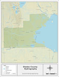
Florida Waterways: Glades County , 2008
This map was created by FCIT and shows the waterways of Glades County. All major rivers, streams, creeks, lakes, and swamps are labeled. This map features the Kissimmee River, Lake Okeechobee, The Everglades, Gopher Gully, Fisheating Creek, Chaparral...

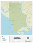
Florida Waterways: Gulf County , 2008
This map was created by FCIT and shows the waterways of Gulf County. All major rivers, streams, creeks, lakes, and swamps are labeled. This map features Stone Mill Creek, Big Branch, Dead Lake, Guardhouse Branch, Sandy Branch, Little Sandy Creek, Wet...

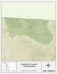
Florida Waterways: Hamilton County , 2008
This map was created by FCIT and shows the waterways of Hamilton County. All major rivers, streams, creeks, lakes, and swamps are labeled. This map features the Withlacoochee River, the Withlacoochee River (North), Alapaha River, Turket Creek, Alliga...

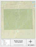
Florida Waterways: Hardee County , 2008
This map was created by FCIT and shows the waterways of Hardee County. All major rivers, streams, creeks, lakes, and swamps are labeled. This map features the Peace River....

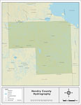
Florida Waterways: Hendry County , 2008
This map was created by FCIT and shows the waterways of Hendry County. All major rivers, streams, creeks, lakes, and swamps are labeled. This map features Jacks Branch, the Caloosahatchee River, Banana Branch, Fort Simmons Branch, Bedman Creek, Long ...

Next Last


  FL Maps > Florida County Hydrography Maps
Site Map  

Maps ETC is a part of the Educational Technology Clearinghouse
Produced by the Florida Center for Instructional Technology © 2007
College of Education , University of South Florida