Maps Site map
  FL Maps > Region > 1950-1999
Site Map  

  Record   151   to   175  of   261

Concentrations of Bicarbonate, Sulfate, and Chloride in Spring Water from the Upper Floridan Aquifer of Ocala National Forest and Lake County, 1990 to 1999
This map from the U. S. Geological Survey Water Resources Investigation Report number 01-4008, Ground-Water Quality of the Surficial Aquifer System and the Upper Floridan Aquifer, Ocala National Forest and Lake County, 1990-99, shows the relative per...

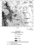
Concentrations of Dissolved Oxygen in Groundwater from the Upper Floridan Aquifer of Ocala National Forest and Lake County, 1990 to 1999
This map from the U. S. Geological Survey Water Resources Investigation Report number 01-4008, Ground-Water Quality of the Surficial Aquifer System and the Upper Floridan Aquifer, Ocala National Forest and Lake County, 1990-99, shows the concentratio...

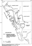
Concentrations of Nitrate in Groundwater and Spring Water from the Upper Floridan Aquifer of Ocala National Forest and Lake County, 1990 to 1999
This map from the U. S. Geological Survey Water Resources Investigation Report number 01-4008, Ground-Water Quality of the Surficial Aquifer System and the Upper Floridan Aquifer, Ocala National Forest and Lake County, 1990-99, shows the concentratio...

Cattle per Square Mile per County in South Florida, 1992
This map from the U. S. Geological Survey Circular 1134, The South Florida Environment, shows the estimated number of cattle per square mile, per county, in south Florida based on 1992 data....

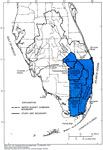
Water Budget Subbasins in Southeastern Florida, 1993
This map from the U. S. Geological Survey Circular 1134, The South Florida Environment, shows the five major water budget subbasins of southeastern Florida as defined by the South Florida Water Management District in 1993. The subbasins include Lake ...

National Parks of South Florida, 1994
This map of South Florida shows the national park current 1994. The four parks are Big Cypress National Preserve, Biscayne National Park, Everglades National Park, and the Dry Tortugas National Park. Each park is bordered in dark green. Of these, the...

Everglades National Park, 1994
This map of the Everglades National Park is a color-coded map of the various Everglades Ecosystems. The portion of the largest green spreading along the coast is coastal marsh. The orange lines are coastal prairie. The brightest green, in the middle ...

Rates of Recharge and Discharge to the Floridan Aquifer System in the Suwannee River Water Management District, 1995
This map from the U. S. Geological Survey Water Resources Investigation Report number 95-4064, Effects of Waste-Disposal Practices on Ground-Water Quality at Five Poultry Farms in North-Central Florida, shows the yearly rates of recharge to and disch...

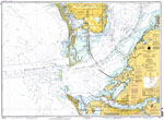
Tampa Bay, Southern Part, 1996
A National Oceanic and Atmospheric Administration map of the southern end of Tampa Bay and its entrance, 1996. This Ocean Survey chart shows all soundings expressed in feet. Navigational aids such as safety fairways, and visual markers such as light...

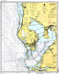
Tampa Bay and St. Joseph Sound, 1996
A National Oceanic and Atmospheric Administration map of Tampa Bay and St. Joseph Sound current to 1996. This Department of Commerce chart shows all soundings expressed in feet at mean lower low water. Navigational aids such as lights, beacons, buoys...

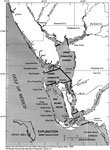
Charlotte Harbor Estuarine System and Subareas, 1996
This map from the U. S. Geological Survey Water Resources Investigation Report number 93-4153, Simulation of Tidal Flow, Circulation, and Flushing of the Charlotte Harbor Esturine System, shows the study area for the simulation of tidal-flow, circula...

Generalized Bottom Configuration of Charlotte Harbor, 1996
This map from the U. S. Geological Survey Water Resources Investigation Report number 93-4153, Simulation of Tidal Flow, Circulation, and Flushing of the Charlotte Harbor Esturine System, shows the generalized bottom configuration of the Charlotte Ha...

Continuous Particle and High Tide Particle Tracks in Charlotte Harbor, 1996
This map from the U. S. Geological Survey Water Resources Investigation Report number 93-4153, Simulation of Tidal Flow, Circulation, and Flushing of the Charlotte Harbor Esturine System, shows an example of particle movements within Charlotte Harbor...

Floodtide Water Transport Vectors in Charlotte Harbor, 1996
This map from the U. S. Geological Survey Water Resources Investigation Report number 93-4153, Simulation of Tidal Flow, Circulation, and Flushing of the Charlotte Harbor Esturine System, shows typical water transport flow patterns during floodtide i...

Ebbtide Water Transport Vectors in Charlotte Harbor, 1996
This map from the U. S. Geological Survey Water Resources Investigation Report number 93-4153, Simulation of Tidal Flow, Circulation, and Flushing of the Charlotte Harbor Esturine System, shows typical water transport flow patterns during ebbtide in ...

High Slack Tide Water Transport Vectors in Charlotte Harbor, 1996
This map from the U. S. Geological Survey Water Resources Investigation Report number 93-4153, Simulation of Tidal Flow, Circulation, and Flushing of the Charlotte Harbor Esturine System, shows typical water transport flow patterns during high slack ...

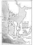
Low Slack Tide Water Transport Vectors in Charlotte Harbor, 1996
This map from the U. S. Geological Survey Water Resources Investigation Report number 93-4153, Simulation of Tidal Flow, Circulation, and Flushing of the Charlotte Harbor Esturine System, shows typical water transport flow patterns during low slack t...

Generalized Thickness of the Surficial Aquifer System in Southwest Florida, 1996
This map from the U. S. Geological Survey Water Resources Investigation Report number 96-4063, Hydrology of the Surficial and Intermediate Aquifer Systems in Sarasota and Adjacent Counties, shows the generalized thickness in feet of the surficial aqu...

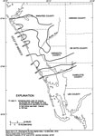
Generalized Altitude of the Base of the Intermediate Aquifer System in Southwest Florida, 1996
This map from the U. S. Geological Survey Water Resources Investigation Report number 96-4063, Hydrology of the Surficial and Intermediate Aquifer Systems in Sarasota and Adjacent Counties, shows the generalized altitude in feet below sea level of th...

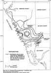
Generalized Thickness and Extent of Permeable Zone 1 of the Intermediate Aquifer System in Southwest Florida, 1996
This map from the U. S. Geological Survey Water Resources Investigation Report number 96-4063, Hydrology of the Surficial and Intermediate Aquifer Systems in Sarasota and Adjacent Counties, shows the generalized thickness in feet of permeable zone 1 ...

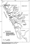
Generalized Thickness of Permeable Zone 2 of the Intermediate Aquifer System in Southwest Florida, 1996
This map from the U. S. Geological Survey Water Resources Investigation Report number 96-4063, Hydrology of the Surficial and Intermediate Aquifer Systems in Sarasota and Adjacent Counties, shows the generalized thickness in feet of permeable zone 2 ...

Generalized Thickness of Permeable Zone 3 of the Intermediate Aquifer System in Southwest Florida, 1996
This map from the U. S. Geological Survey Water Resources Investigation Report number 96-4063, Hydrology of the Surficial and Intermediate Aquifer Systems in Sarasota and Adjacent Counties, shows the generalized thickness in feet of permeable zone 3 ...

Generalized Thickness and Extent of the Venice Clay in Southwest Florida, 1996
This map from the U. S. Geological Survey Water Resources Investigation Report number 96-4063, Hydrology of the Surficial and Intermediate Aquifer Systems in Sarasota and Adjacent Counties, shows the generalized thickness in feet of Venice Clay unit ...

Generalized Topography of the Greater Orlando Metropolitan Area, 1996
This map from the U. S. Geological Survey Water Resources Investigation Report number 96-4181, Hydrogeologic Conditions and Simulation of Ground Water Flow in the Greater Orlando Metropolitan Area, shows the generalized topography of the area by alti...

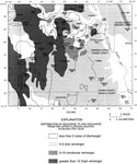
Distribution of Recharge and Discharge of the Upper Floridan Aquifer in the Greater Orlando Metropolitan Area, 1996
This map from the U. S. Geological Survey Water Resources Investigation Report number 96-4181, Hydrogeologic Conditions and Simulation of Ground Water Flow in the Greater Orlando Metropolitan Area, shows the generalized distribution of recharge to an...

First Previous Next Last


  FL Maps > Region > 1950-1999
Site Map  

Maps ETC is a part of the Educational Technology Clearinghouse
Produced by the Florida Center for Instructional Technology © 2007
College of Education , University of South Florida