War of 1812
The War of 1812 was America’s Second War of Independence.
War of 1812 Banner
Use this banner on social media to share this collection of resources related to the War of 1812.
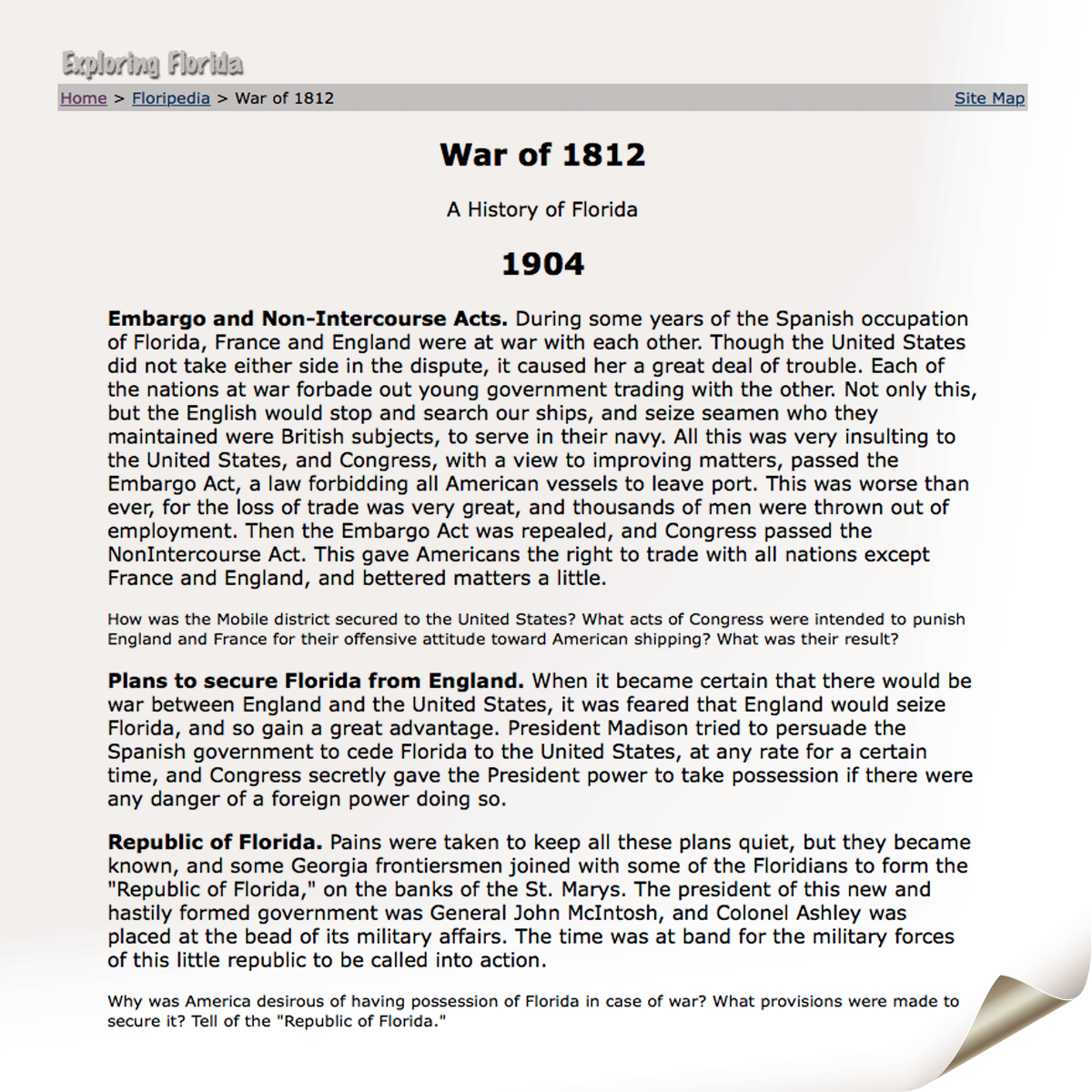
War of 1812 in Florida
An introduction to the War of 1812 from the History of Florida on the Exploring Florida website.
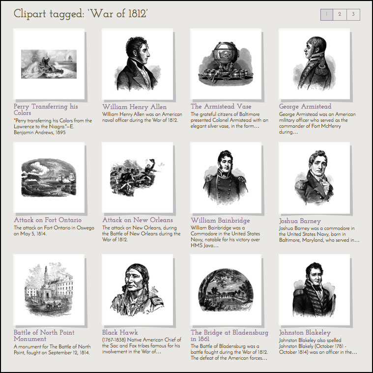
War of 1812 Illustrations
Over 120 historical illustrations of people, places, and events of the War of 1812 from the ClipArt ETC website.
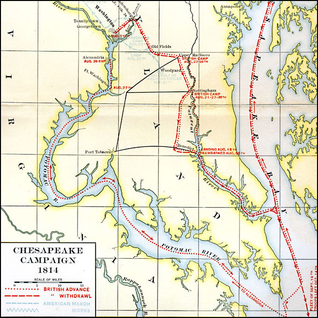
Chesapeake Campaign, 1814
A map of the Chesapeake Campaign (1814) of the War of 1812 showing the routes of British advance and retreat on the capture of the city of Washington and Battle of Baltimore, the routes of the American forces, American fortifications, and battle sites. From the Maps ETC website.
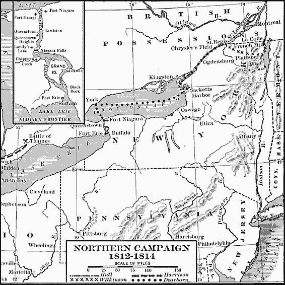
Northern Campaign
A map of the Great Lakes region of North America showing the area of conflict during the northern campaign of the War of 1812, from Lake Michigan east to Lake Champlain and the Hudson River. From the Maps ETC website.
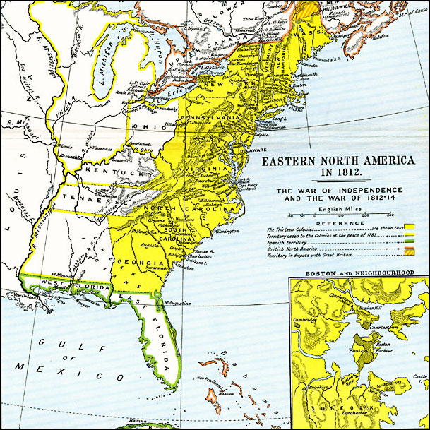
Eastern North America
A map of eastern North America in 1812 subtitled ‘The War of Independence and the War of 1812–1814.’ From the Maps ETC website.
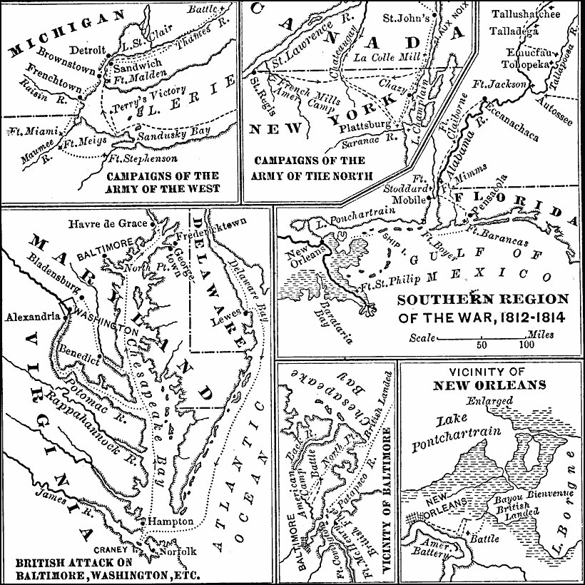
Southern Region of the War of 1812, 1812–1815
Map showing details of the campaigns of the Army of the West (Fort Stephenson, Fort Meigs, Perry’s victory on Lake Erie, and the Battle of the Thames River), campaigns of the Army of the North (French Mills, Montreal, and Plattsburg), campaigns of the south (Forth Strother, Tohopeka, Autossee, Fort Claiborne, Fort Mims, Pensacola, and New Orleans), and details of the British attack on Baltimore and Washington, the vicinity of Baltimore, and the vicinity of New Orleans.
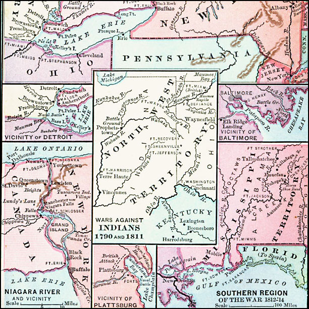
The War of 1812, 1812–1815
Map of the War of 1812–1814 between the United States and England, with insets detailing the northern region of the Great Lakes east to Lake Champlain, the vicinity of Detroit, the vicinity of Baltimore, the Niagara River and vicinity, the vicinity of Plattsburg, and the southern region of the war.
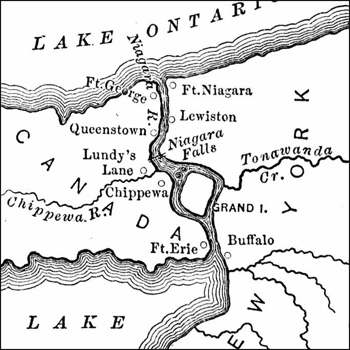
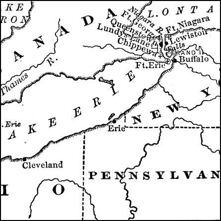
Niagara River during the War of 1812
A map of the Niagara River between Lake Erie and Lake Ontario during the War of 1812 (1812–1815), showing the forts Erie, George, and Niagara, and the towns and battle sites of Lewiston, Queenstown, Lundy’s Lane, Chippewa, and Buffalo.
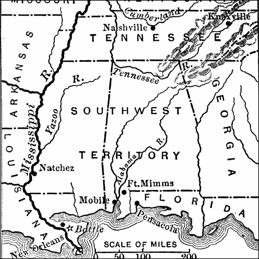
The Southwestern Operations, 1813–1815
A map of the area south of the Cumberland River to the Gulf of Mexico showing major sites and southwestern operations of the War of 1812, including Nashville (Jackson appointed commander of the Tennessee militia), Fort Mimms (Creek Wars), and New Orleans, site of the final battle of the war.
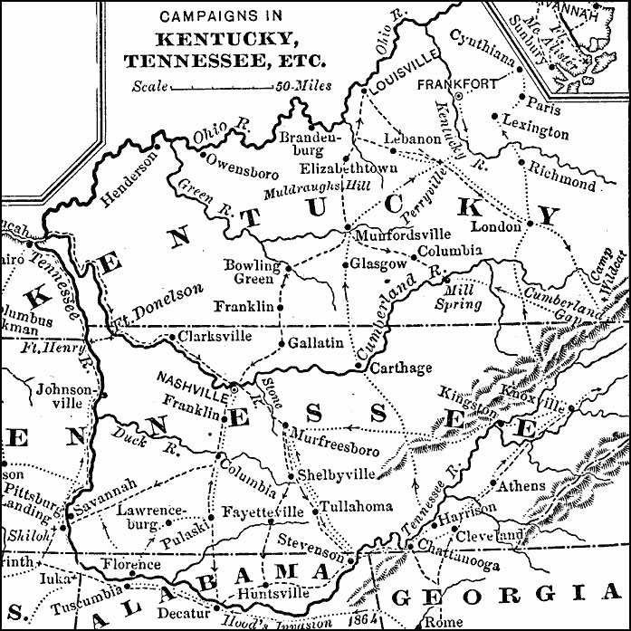
Campaigns in Kentucky and Tennessee, 1812–1814
A map of Kentucky, Tennessee, northern Mississippi, Alabama, and Georgia, showing the battle sites and routes of campaigns during the War of 1812.
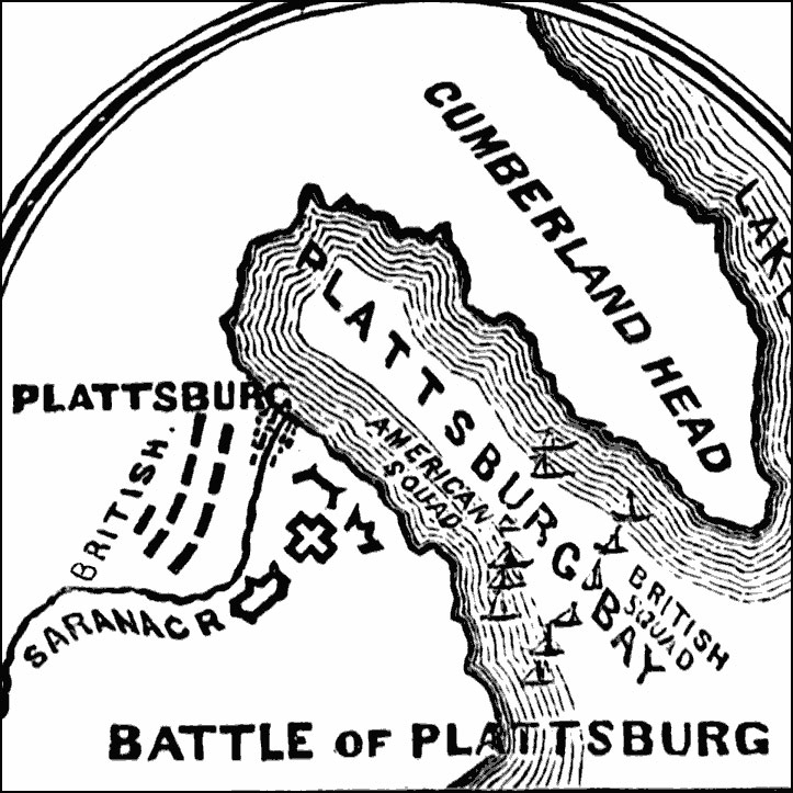
Battle of Plattsburg, 1814
A map of the site of the Battle of Plattsburg on Lake Champlain, New York, during the War of 1812. The map shows the town located on Plattsburg Bay at the mouth of the Saranac River, the American redoubts and defenses on the south bank of the river, the British troop positions on the north bank, and the positions of the American and British ships in the Bay.
The War of 1812 on the Canadian Border
Location of the War of 1812 on the Canadian border.
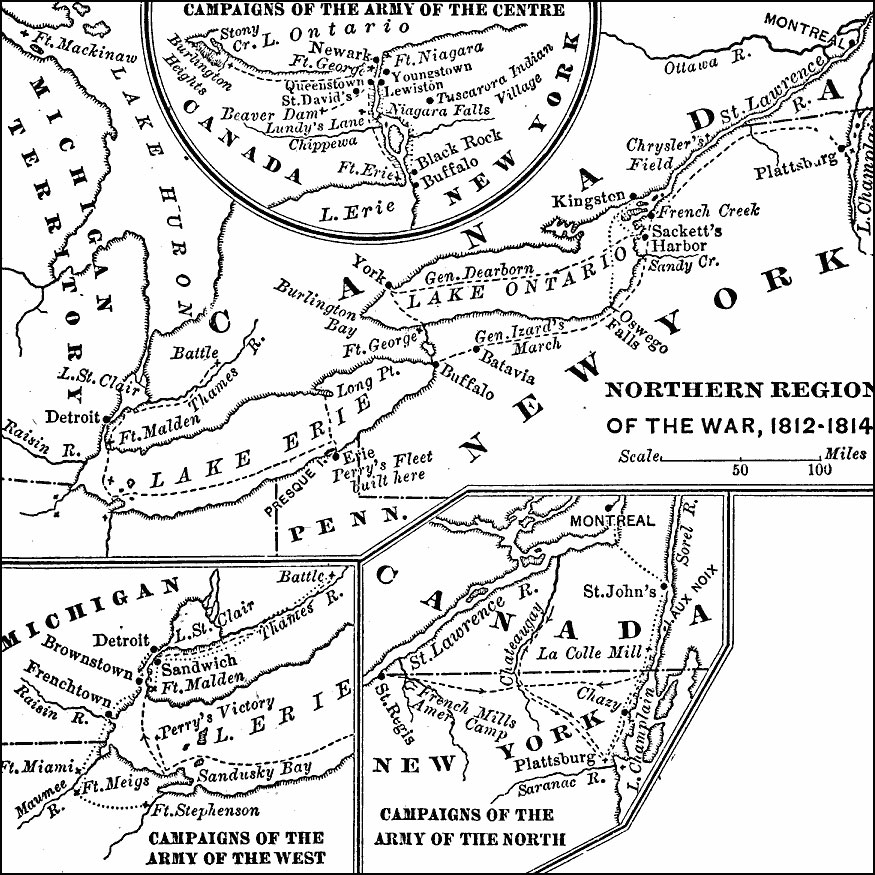
Northern Region of the War of 1812
Detail maps of the campaigns of the Army of the Centre (Lundy’s Lane, Beavers Dam, and Burlington Heights), campaigns of the Army of the West (Fort Stephenson, Fort Meigs, and the Battle of the Thames River), campaigns of the Army of the North (French Mills, Montreal, and Plattsburg) and an expanded map of the region showing the campaign routes from the Great Lakes to Montreal on the St. Lawrence River.
Battle of New Orleans, 1815
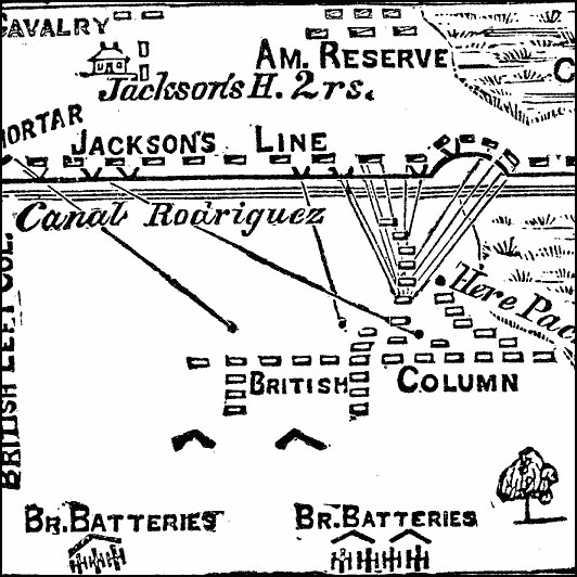
A plan of the Battle of New Orleans (January 8, 1815), the final battle of the War of 1812. The map shows the headquarters of Andrew Jackson, the positions of the Americans and the British, and marks the site where General Edward Packenham (British commander) fell.

