August 15: Panama Canal
On this day in 1914, the Panama Canal opened to shipping traffic, connecting the Atlantic and Pacific Oceans. The opening of the Canal came some 400 years after Balboa became the first European to cross the isthmus of Panama. Proposals for completing a canal across Central America were made as early as 1534. Thomas Jefferson suggested that the Spanish create the canal and the French made a grand attempt in the 1880s, but failed. It was not until the United States purchased the French interests and negotiated a treaty with the newly-formed Republic of Panama that the project was brought to completion. Our resource collection includes a variety of historic maps and illustrations of some of the principal players in the Canal’s history.
Curriculum connections: Balboa, canals, Central America, civil engineering, Columbia, development of transportation networks, engineering, imperialism, isthmus, Latin America, locks, map reading, Panama, Panama Canal, rise of the United States as a world power, Roosevelt Corollary, segregation, shipping, Theodore Roosevelt, trade, transportation, U.S. expansion, yellow fever.
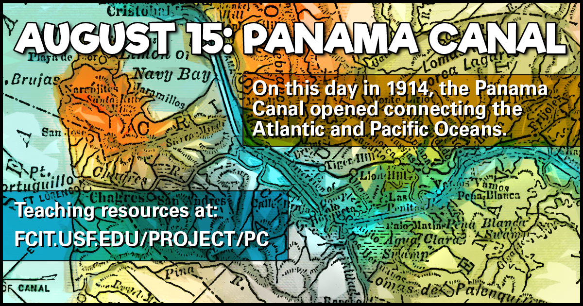
Panama Canal Banner
Use this banner on social media to share our collection of Panama Canal teaching resources.
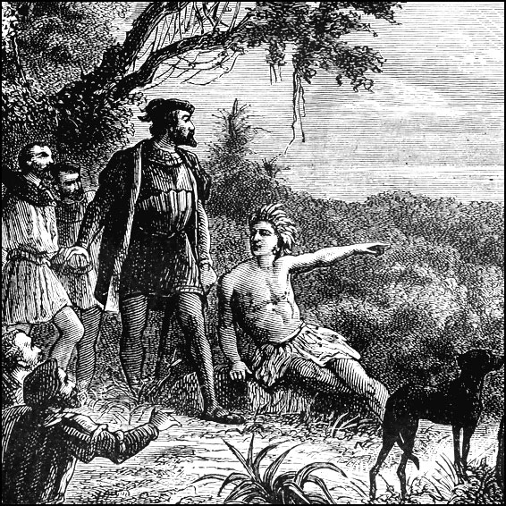
Balboa Sighting the Pacific Ocean
Balboa was the first European to cross the isthmus of Panama to the Pacific Ocean. Illustration from the ClipArt ETC website.
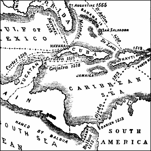
Early Voyages of the Spaniards
Map of Spanish voyages in America shows route of de Ojeda to Panama. From the Maps ETC website.
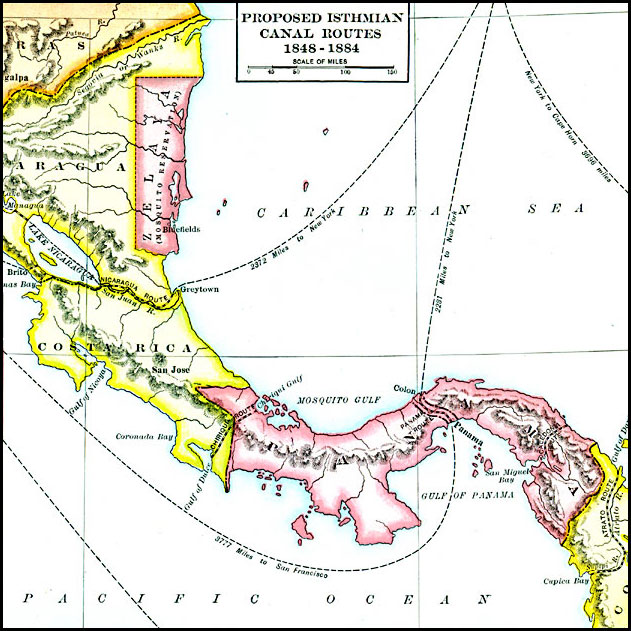
Proposed Isthmian Canal Routes, 1848–1884
A map of the proposed isthmian canal routes in Nicaragua and Panama between 1848–1884. The map shows the two chief proposals, the Nicaraguan from Greytown on the Caribbean to Lake Nicaragua and Brito on the Pacific, and the Panama proposal from Colon on the Caribbean to Panama City on the Pacific. All shown are four additional proposed routes. From the Maps ETC website.
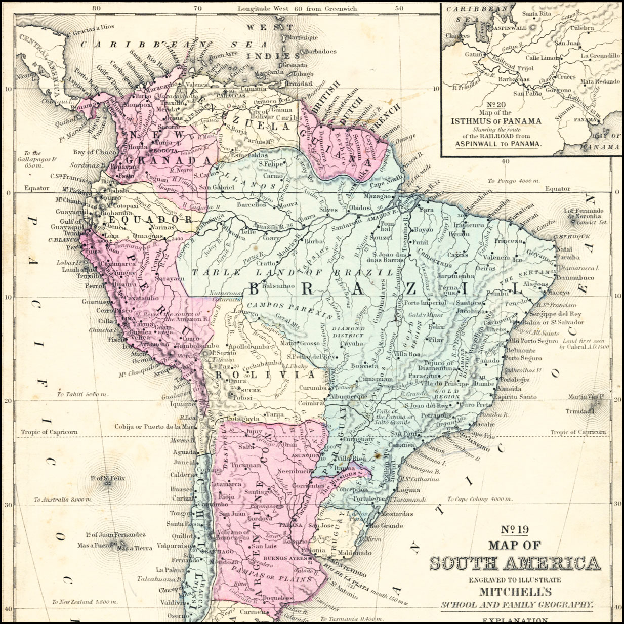
South America, 1858
Map of 1858 showing Panama as a part of New Granada. New Granada changed its name in 1858 to the Granadine Confederation and then again in 1863 to the United States of Columbia. The Department of Panama separated from the USC in 1903 and became an independent nation. An inset map details the Isthmus of Panama before construction of the canal, showing the railroad route between Aspinwall on the Caribbean and Panama City on the Pacific. From the Maps ETC website.
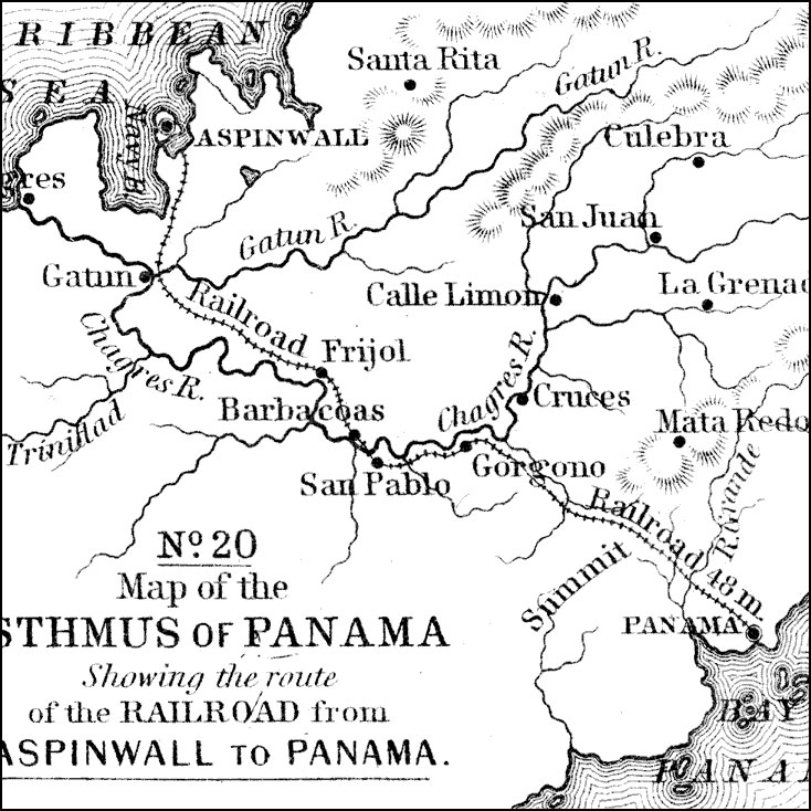
Isthmus of Panama, 1858
A map from 1858 of the Isthmus of Panama showing the 48 mile route of the railroad line between Aspinwall on the Caribbean and Panama on the Pacific. This is proposed site of the Panama Canal. The map shows towns along the route, and rivers, terrain, and coastal features of the area. From the Maps ETC website.
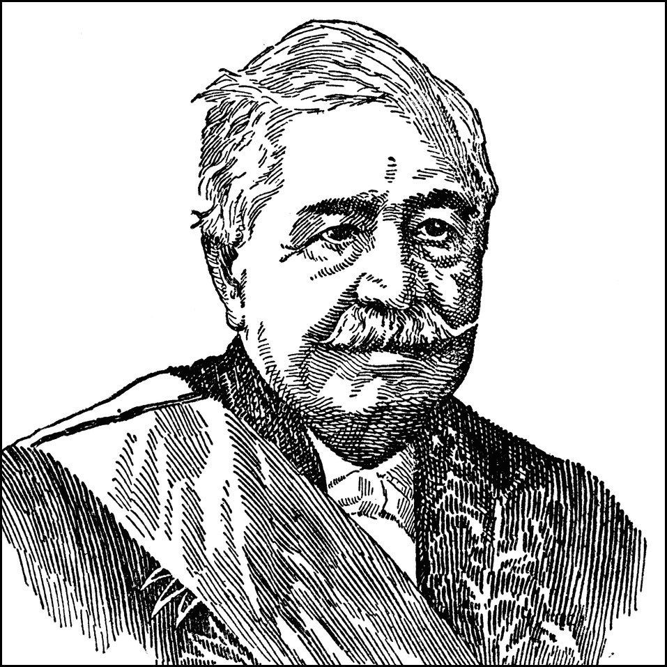
Count Ferdinand de Lesseps
De Lesseps (1805-1894) was the successful developer of the Suez Canal. He attempted the construction of a sea-level Panama Canal beginning in 1881, but by 1889 the project had become bankrupt after spending $287 million and losing as estimated 22 thousand lives. The project was eventually sold to the United States in 1902. Portrait from the ClipArt ETC website.
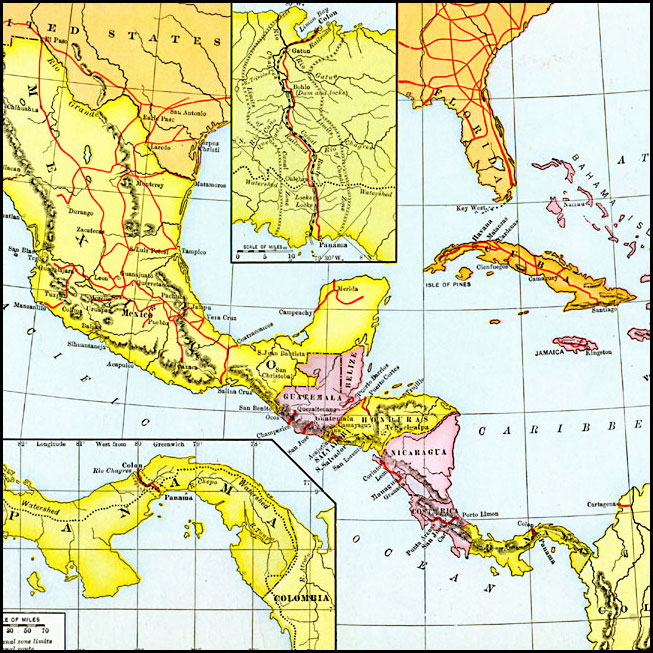
West Indies and Mexico, 1898–1906
A map of the West Indies and Mexico between 1898 and 1906, showing political boundaries at the time, capitals, major cities and ports, railroads and canals, rivers, terrain, islands, and coastal features of the region. Note the railroad across Panama. From the Maps ETC website.
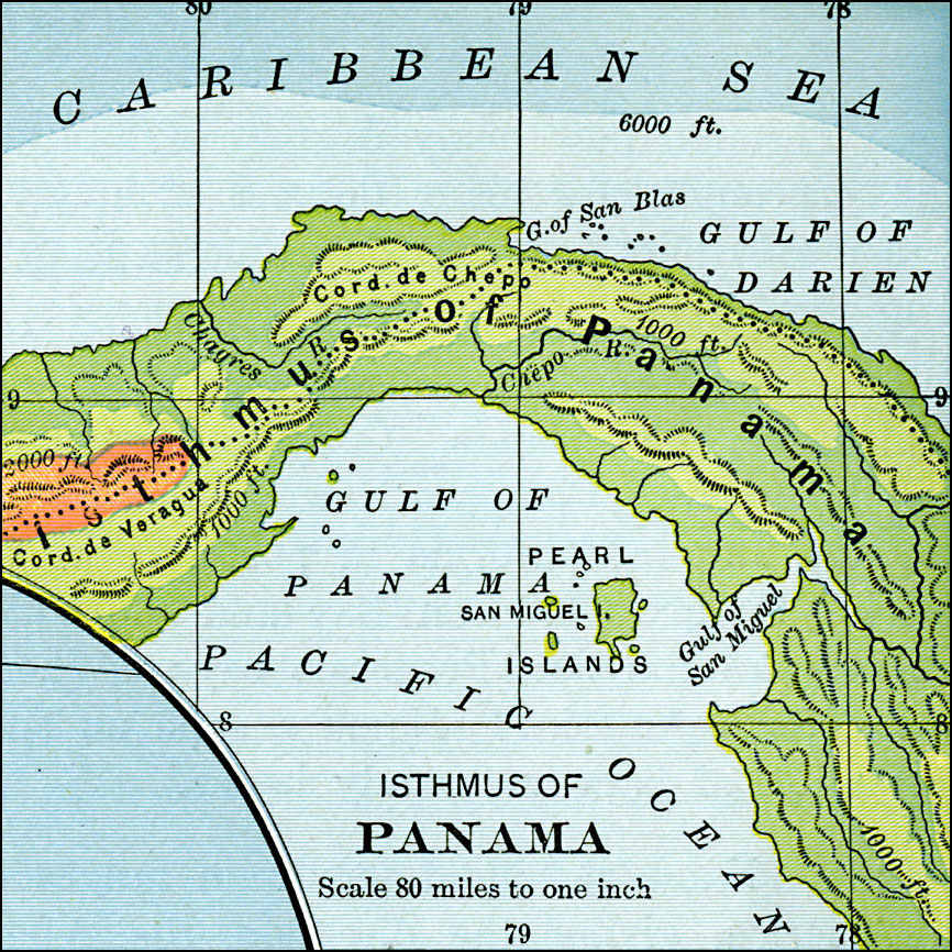
Isthmus of Panama, 1901
A map from 1901 of the Isthmus of Panama, showing the Charges River–an integral part of the Panama Canal system. The map uses color–contouring to show general elevations, with dark green areas from sea level to 1,000 feet, light green areas from 1,000 to 2,000 feet, and brown areas above 2,000 feet. The continental divide is indicated by the dotted line. From the Maps ETC website.
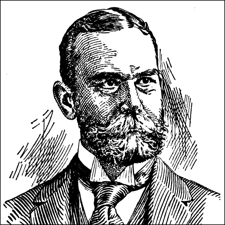
John Hay
John Hay‘s long political career began in the Lincoln administration. He served a Secretary of State under Presidents McKinley and Theodore Roosevelt. A SoS, he negotiated the unratified Hay–Herrán Treaty with Colombia and the Hay–Bunau-Varilla Treaty with the newly-independent Republic of Panama that allowed for the building of the Panama Canal. Illustration from the ClipArt ETC website.
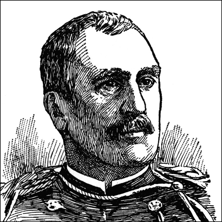
George Whitefield Davis
George Whitefield Davis (July 26, 1839 – July 12, 1918) was an engineer and Major General in the United States Army. He served as the first Governor of the Panama Canal Zone (1904-1905). Illustration from the ClipArt ETC website.
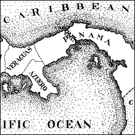
Panama, 1906
A map from 1906 of the Isthmus of Panama showing the railroad from Colon to the city of Panama, the projected route of the canal, the provinces of Panama at the time (Chiriqui, Veraguas, Azuero, and Panama), and the borders with Costa Rica to the north and the United States of Columbia to the south. From the Maps ETC website.
United States Canal Zone, 1909
United States Canal Zone and the isthmus of Panama from the Maps ETC website.
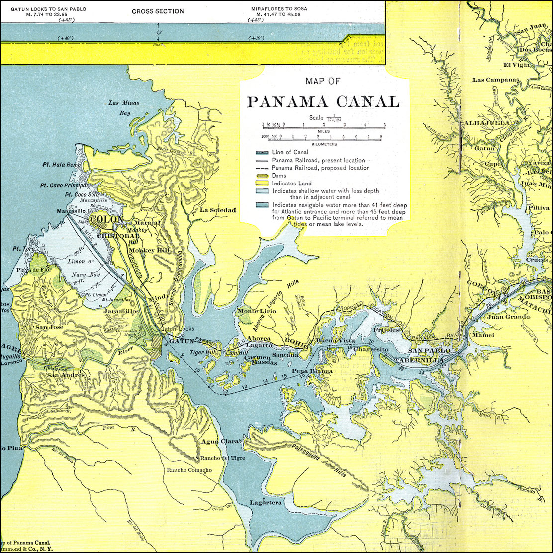
Panama Canal, 1911
A map from 1911 of the Panama Canal, showing the line of the canal with the miles from Colon given, the existing and proposed location of the Panama Railroad, dams, feeding rivers and mountains, towns and roads, and water depths. The water depths are color–coded to show shallow water with less depth than the adjacent canal, and navigable water more than 41 feet deep for the Atlantic entrance and more than 45 feet deep from Gatun to Pacific terminal. From the Maps ETC website.
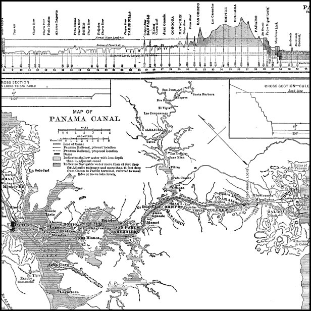
Panama Canal, 1912
A map from 1912 of the Panama Canal showing the line of the canal, areas of navigable water, and areas of shallow water that have less depth than the canal. Included are insert maps of a cross section of the Gatun Locks to San Pablo and a cross section of the Culebra cut. A profile of the Panama Canal showing length, elevation, locks, and land to be excavated is also given. From the Maps ETC website.
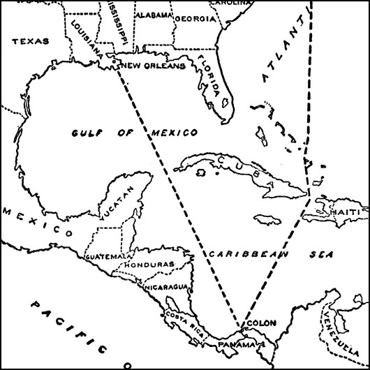
Routes to the Panama Isthmus, 1913
A map from 1913 of the eastern United States, the Caribbean, and the Panama Isthmus showing the directness of the steamship routes from New York and New Orleans to Colon. Since the Panama Canal did not open to commercial traffic until 1914, this map was used to promote the canal over the trans–continental rail or shipping around the southern tip of South America as a means of transporting goods. From the Maps ETC website.
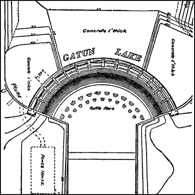
Gatun Dam Spillway, 1913
A plan of the Gatun Dam spillway on the Panama Canal. The Gatun Dam was constructed from 1907 to 1913. At the time it was built, it was the largest earth dam in the world and Gatun Lake was the largest man made lake in the world. From the Maps ETC website.

Completed Panama Canal, 1914
A map from 1914 of the completed canal across the Isthmus of Panama. The map shows the Caribbean Sea entrance at Colon, the route of the canal through Gutan Lake and lock system, the Pacific entrance at the city of Panama, the Canal Zone boundary with the Republic of Panama, the continental divide, railroads, cities and towns, mountains, islands, and coastal features. From the Maps ETC website.
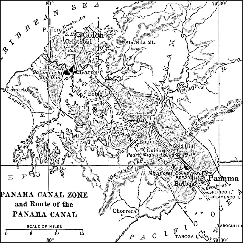
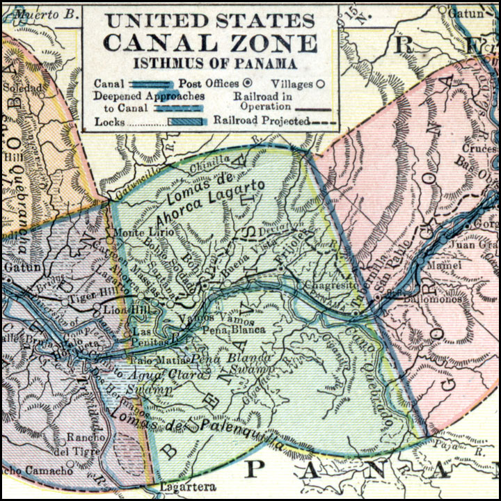
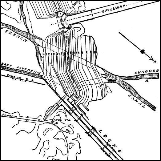
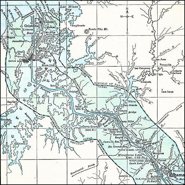
Panama Canal Zone, 1915
The Panama Canal Zone and route of the Panama Canal. The Panama Railroad line between Colon and Panama City is shown, as well as he Gantun locks, Pedro Miguel locks, and the Miraflores locks. Natural features include Limon Bay, Gatun Lake, and the continental divide. from the Maps ETC website.
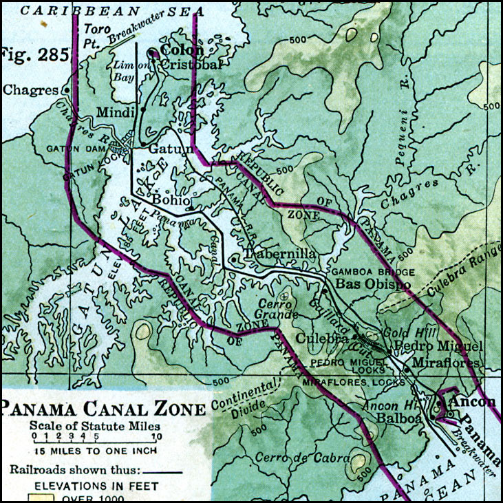
Panama Canal Zone, 1916
The map uses color–contouring to show elevations from sea level to 500 feet in dark green, 500 to 1000 feet in light green, and over 1000 feet in buff tint. The map also shows the boundaries between the Canal Zone and the Republic of Panama, the Panama Railroad, dams and locks, and towns in the area. From the Maps ETC website.
Panama, 1919
A map from 1919 of the Panama Canal Zone showing the completed canal, the Panama Railway, the locks, breakwaters and dams, the Caribbean entry at Colon and Pacific entry at the City of Panama, the boundary with the Republic of Panama, the continental divide, hills, lakes with elevations, and feeding rivers of the area. From the Maps ETC website.
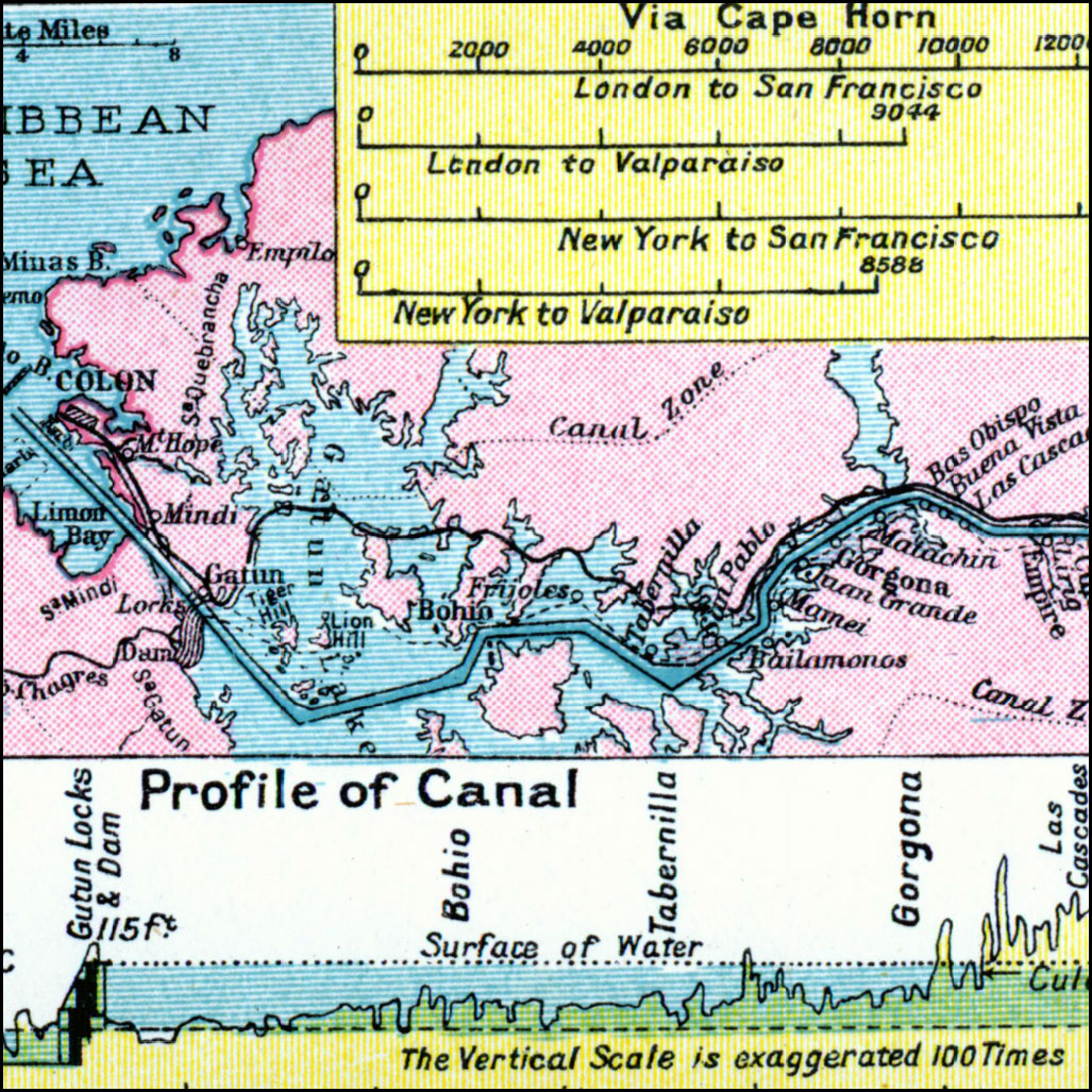
Panama Canal, 1920
A map from 1920 of the Panama Canal showing the Canal Zone boundaries and the channel route from Colon to the city of Panama. A chart at the top of the map shows the comparative port to port distances via the canal and via the Cape Horn route. The chart at the bottom of the map is a profile of the isthmus and canal with a vertical exaggeration 100 times actual. From the Maps ETC website.
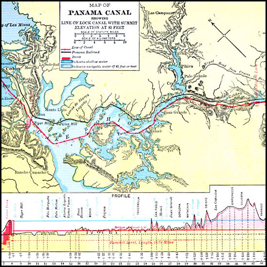
Panama Canal, 1920
A map from 1920 of the Panama Canal showing the channel route from Colon to the city of Panama. A chart at the bottom of the map shows a profile of the isthmus with the canal system of locks and the dam necessary to reach a water–surface elevation of 85 feet to transfer ships from the Atlantic or Pacific. From the Maps ETC website.
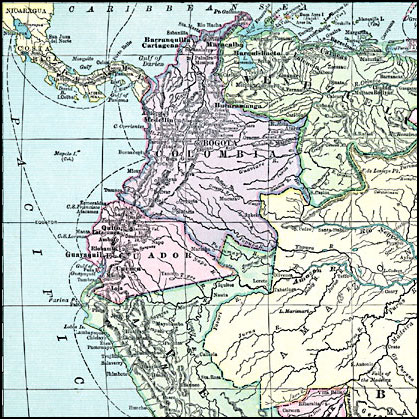
Northern South America, 1920
A map from 1920 of the northern part of South America from the Maps ETC website. Compare with the map of 1858 when Panama was a part of New Granada (Columbia).
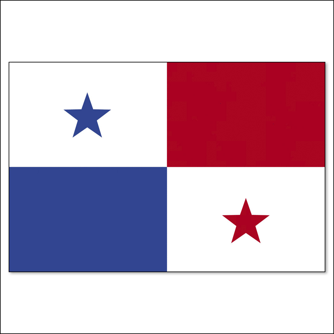
Flag of Panama
Current flag of Panama from the ClipArt ETC website.
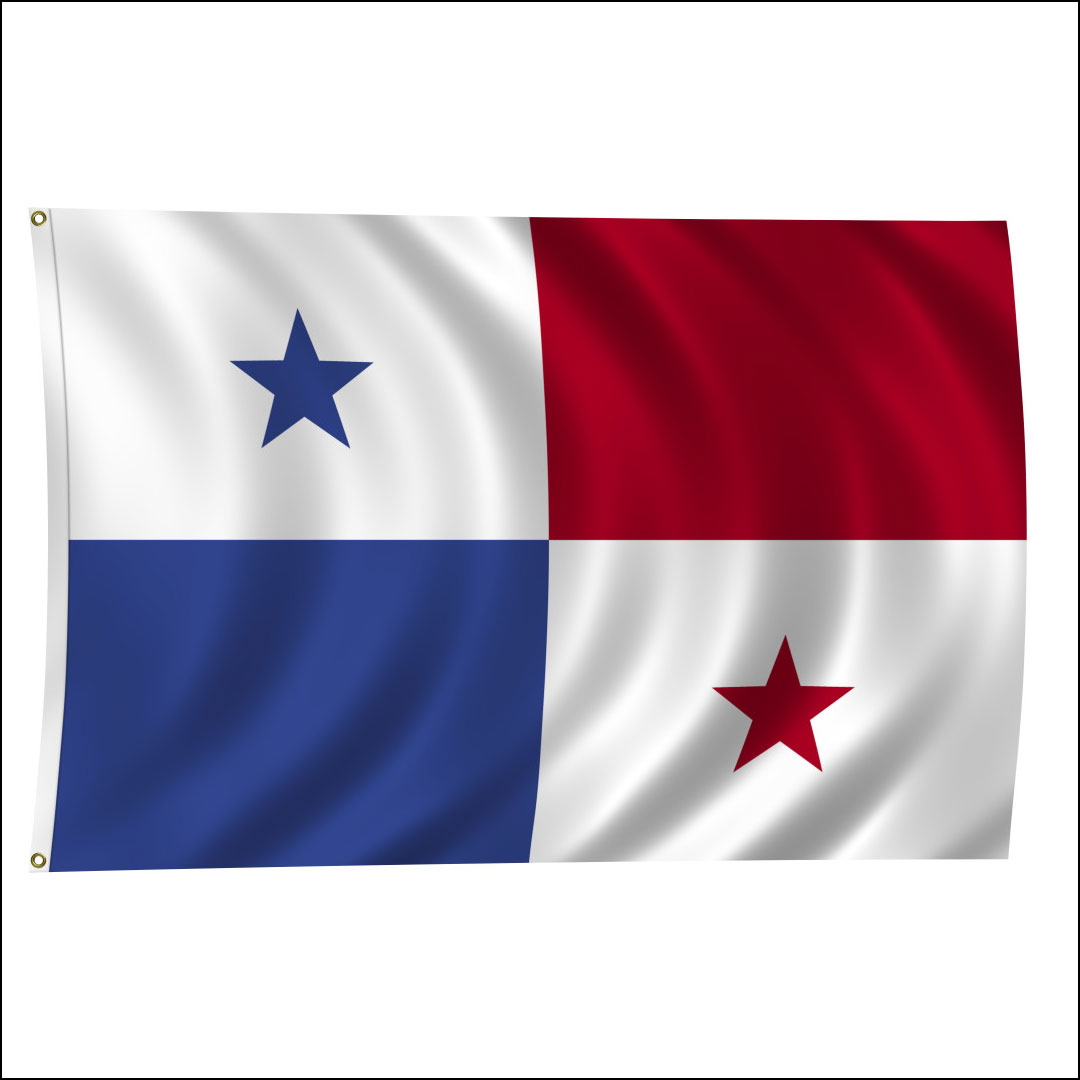
Flag of Panama
Current flag of Panama from the ClipPix ETC website.