At first glance, individual ClipPix ETC galleries of historic drawings or recent photographs of old buildings might not seem to have much application to school subjects. However, matching up architectural drawings and photos of the same location provides some very interesting possibilities:
English Language Arts. Gathering these visual resources around significant historic locations gives students the opportunity to integrate information expressed visually with their written text—a skill referenced repeatedly throughout the ELA Common Core Standards. What information is best expressed verbally? What information is best expressed in a photo or drawing?
History. Each of the photo/drawing pairs of galleries represents a location with an important history that can be enriched by an examination and comparison of the contemporary photos and the older drawings. What can we learn from the drawings that we can’t from the photos? And vice versa.
Map Skills. Many students have a difficult time making sense of abstract maps and plans. For these students, the drawings will make much more sense since they are paired with a gallery of photos of the same location. Can you match a specific photo with one of the drawings? Where would the photographer have been standing to take this photo?
Math. The dimensions and scales represented in the drawings provide opportunities to apply math skills to real-world situations. How much material was required for the construction? What is the volume of the spaces?
In any subject area where the ability to read and make sense of a drawing or schematic is important, these galleries provide a range of opportunities to study floor plans, elevation drawings, and cross-section drawings. It’s also an opportunity to become familiar with the various conventions used in such drawings. At some point in our lives we pretty much all need to be able to read floor plans of a house or apartment, find our way to a particular office in a large building, or locate a store in a shopping mall. When a fire alarm sounds in a hotel, it’s a little late to learn how to read the posted exit plan. These galleries include both simple and more complex drawings that can be appropriate for use in different grade levels.
Following are five historic locations that are represented by both a gallery of photographs and a gallery of floor plans and elevation drawings. Consider the possibilities!
Castillo de San Marcos, St. Augustine, Florida
The Castillo de San Marcos (Spanish for “St. Mark’s Castle”) is the oldest masonry fort in the continental United States. It is located on the western shore of Matanzas Bay in the city of St. Augustine, Florida. Background information is available in the free NPS iBook, The Castillo de San Marcos.
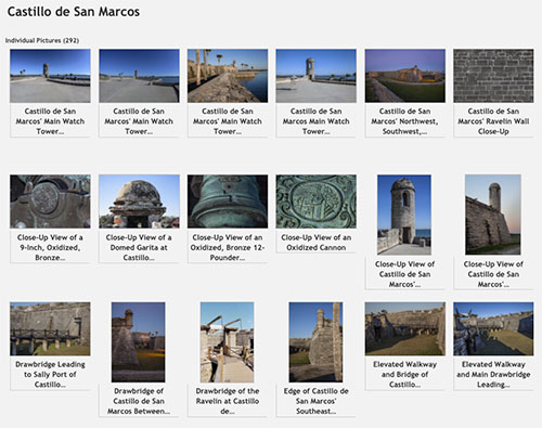
292 photographs of Castillo de San Marcos
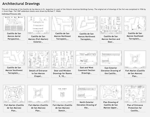
20 plan and elevation drawings of Castillo de San Marcos
Mission San Juan Capistrano, San Antonio, Texas
Mission San Juan Capistrano is one of four Spanish missions comprising the San Antonia Missions National Park. Background information is available in the free NPS iBook, San Antonio Missions: Spanish Influence in Texas.
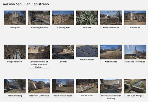
44 photographs of Mission San Juan Capistrano
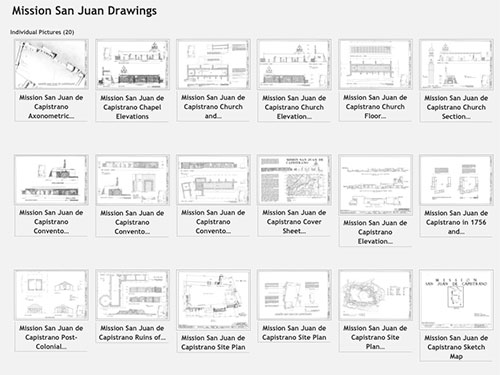
20 plan and elevation drawings of Mission San Juan Capistrano
Gran Quivira, Salinas Pueblo Missions National Monument, New Mexico
Gran Quivira is one of three pueblo missions comprising the Salinas Pueblo Missions National Monument in New Mexico. Background information is available available in the free NPS ibook, Gran Quivira: A Blending of Cultures in a Pueblo Indian Village.
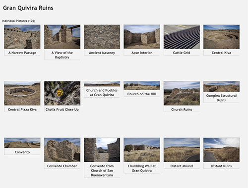
106 photographs of the Gran Quivara ruins at the Salinas Pueblo Missions National Monument
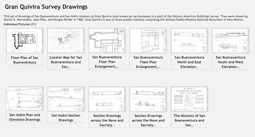
11 plan and elevation drawings of San Buenaventura and San Isidro missions at Gran Quivira
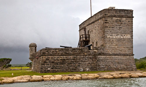
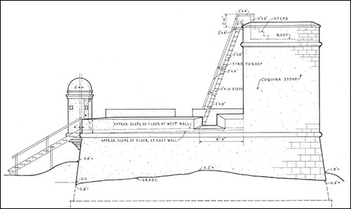
Fort Matanzas National Monument, Florida
Fort Matanzas National Monument preserves the fortified coquina watchtower, completed in 1742, which defended the southern approach to the Spanish military settlement of St. Augustine. Background information is available in the free NPS iBook, The Castillo de San Marcos.
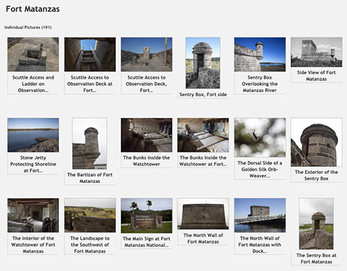
191 photographs of Fort Matanzas
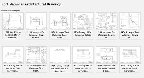
13 plan and elevation drawings of Fort Matanzas
The Old City Gates, St. Augustine, Florida
The Old City Gates in St. Augustine were built in 1808 as a line of defense for the city. Background information is available in the free NPS iBook, The Castillo de San Marcos.
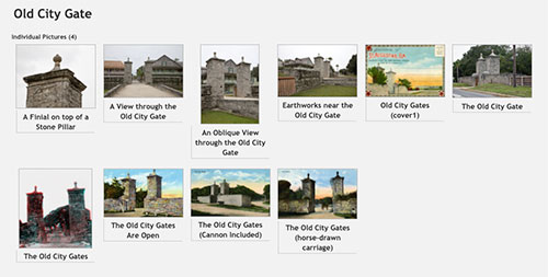
10 photographs of the Old City Gates
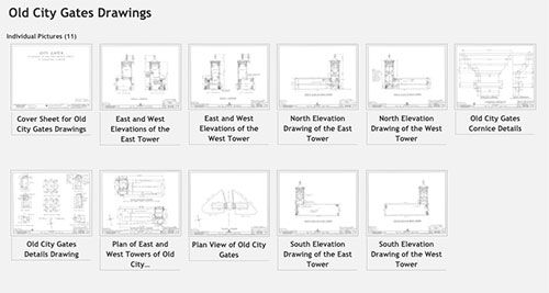
11 plan and elevation drawings of the Old City Gates
Roy Winkelman is a 40+ year veteran teacher of students from every level kindergarten through graduate school. As the former Director of FCIT, he began the Center's focus on providing students with rich content collections from which to build their understanding. When not glued to his keyboard, Dr. Winkelman can usually be found puttering around his tomato garden in Pittsburgh. Questions about this post or suggestions for a future topic? Email me at winkelma@usf.edu. To ensure that your email is not blocked, please do not change the subject line. Thank you!
FCIT Newsletter
Each month FCIT publishes a newsletter with short articles on teaching and learning with technology, using digital content in the classroom, and technology integration. Subscribe today! The subscription form will open in a new window. When you have subscribed, you can close the new window to return to this page.