|
|
|
| FL Maps > Local > Monroe |
Click on a thumbnail image to view a full size version of that map.
|
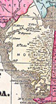
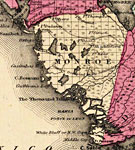
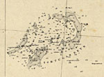
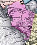
Monroe County - Mainland,
1860 |
|
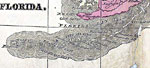
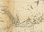
Monroe County - Keys,
1860 |
|
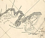
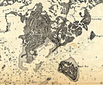
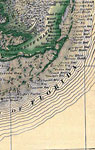
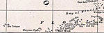
Detail - Preliminary chart of the northeastern part of the Gulf of Mexico,
1861 |
|
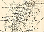
Detail - Preliminary chart of the northeastern part of the Gulf of Mexico,
1861 |
|
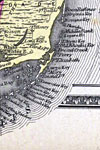
Detail - Cedar Keys, Florida,
1861 |
|
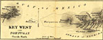
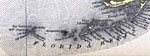
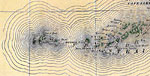
Detail - Key West and Dry Tortugas,
1862 |
|
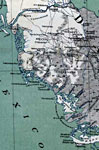
Monroe County - Mainland,
1863 |
|
Monroe County - Keys,
1863 |
|
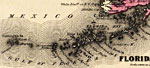
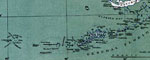
Detail - Preliminary chart of western end of Florida Reefs including Tortugas Keys,
1863-1864 |
|
Detail - Preliminary chart of western end of Florida Reefs including Tortugas Keys,
1863-1864 |
|
Monroe County - Mainland,
1865 |
|
Monroe County - Keys,
1865 |
|
Monroe County - Mainland,
1873 |
|
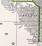
Monroe County - Upper Keys,
1873 |
|
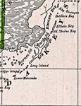
Monroe County - Lower Keys,
1873 |
|
Monroe County- Upper Keys,
1880 |
|
Monroe County- Lower Keys,
1880 |
|
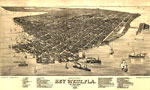
Bird's Eye View of Key West, Fla.,
1884 |
|
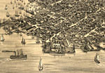
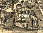
Detail - Bird's Eye View of Key West, Fla.,
1884 |
|
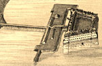
Detail - Bird's Eye View of Key West, Fla.,
1884 |
|
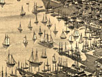
Detail - Bird's Eye View of Key West, Fla.,
1884 |
|
Detail - Bird's Eye View of Key West, Fla.,
1884 |
|
Monroe County Mainland,
1886 |
|
Monroe County- Upper Keys,
1886 |
|
Monroe County- Lower Keys,
1886 |
| First | Previous | Next | Last |
| FL Maps > Local > Monroe |
Maps ETC
is a part of the
Educational Technology Clearinghouse
Produced by the
Florida Center for Instructional Technology
© 2007
College of Education
,
University of South Florida