For the past 30 years, November has been celebrated in the US as Native American Indian Heritage Month. We have assembled a variety of digital resources from FCIT’s collections to support classroom activities related to Native American Indian heritage. The collections and artifacts below include:
- High school level audiobooks and reading passages.
- The Gran Quivira iBook is suitable for middle and high school students and includes information about the Puebloan People of the American Southwest.
- The Native American music can be used at all levels.
- The maps can introduce an exploration of how tribes were removed westward as the colonies, and then states, expanded.
- The illustrations can can be used for activities around historic events, cultural practices, and Native American artifacts.
- Reading passages on Native Americans in Florida at the upper elementary reading level.
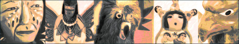
- Finally, the photos offer additional views of artifacts for study. The dolls from the Ann E. Barron Multicultural Miniatures Collection can lead to interesting activities even in the youngest grades. Although the dolls are contemporary creations, they are from the region indicated and are generally made with traditional natural materials.

Speech Cautioning Americans To Deal Justly with His People
Chief Seattle was a Duwamish chief, also known as Sealth, Seathle, Seathl, or See-ahth, and a leader of the Suquamish and Duwamish Native American tribes in what is now the U.S. state of Washington. Listen to this speech from 1854 on the Lit2Go website. Duration: 10 minutes 44 seconds.
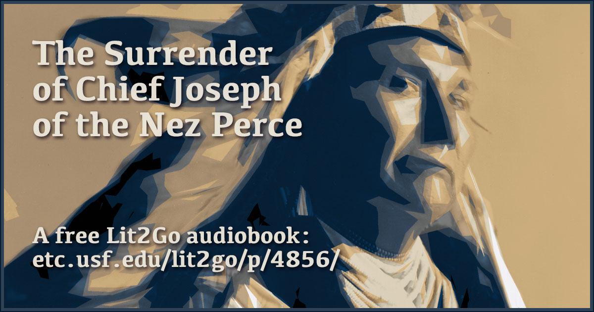
The Surrender of Chief Joseph
Chief Joseph of the Nez Perce surrenders to General Nelson A. Miles in October of 1877. A short passage from the Lit2Go website. Duration: 1 minute 28 seconds.
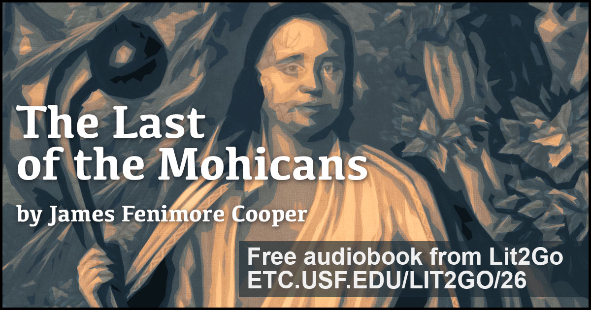
The Last of the Mohicans
The Last of the Mohicans by James Fenimore Cooper is a novel that takes place during the French and Indian War following the adventures of Nathaniel “Natty” Bumppo and his two Mohican companions as they attempt to rescue the daughters of a British commander. Listen to the Lit2Go audiobook.
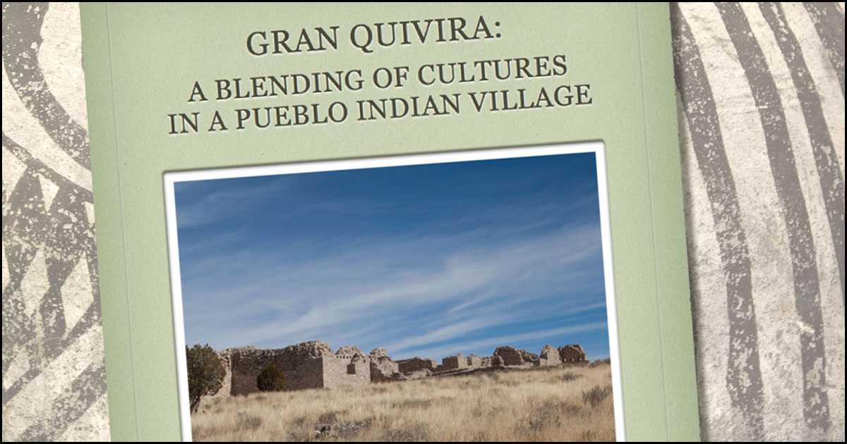
Gran Quivira iBook
The Gran Quivira: A Blending of Cultures in a Pueblo Indian Village iBook is the story of the Native American Puebloan People and the Spanish attempt to bring roughly 10,000 American Indians into Spanish society. Created by FCIT for the NPS as a part of the Hispanic Heritage iBook series. 76 pages + 76 glossary terms, 52 MB download
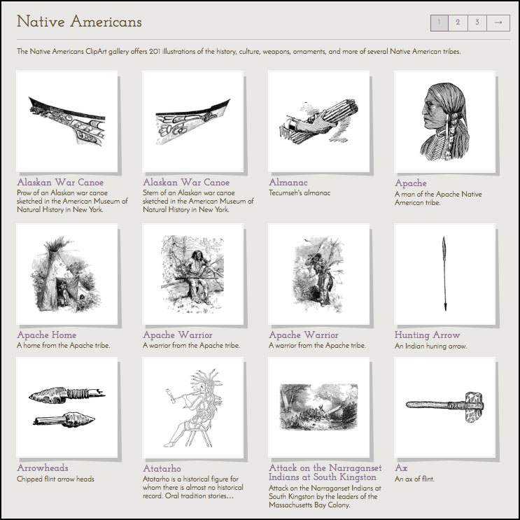
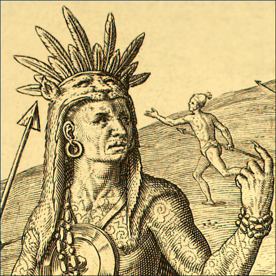
Native American Illustrations
Two hundred illustrations of Native Americans and their customs, housing, and other artifacts from the ClipArt ETC website.
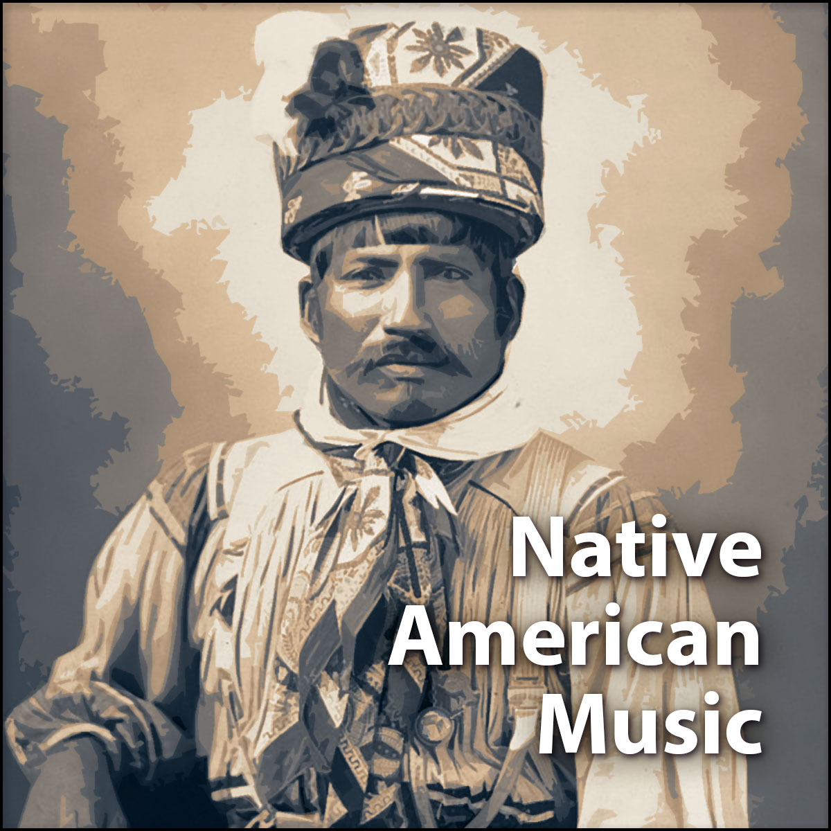
Native American Music
Six Native American songs and chants from the Florida Memory Program. Performers include Josie Billie, Fred Beaver, and Billy Bowlegs III.

Native American on ClipPix
The Native American ClipPix gallery includes a mix of pottery, dolls, and architectural ruins. Photographs from the ClipPix ETC website.
Le Moyne Engravings
A collection of 10 galleries of engravings based on drawings Le Moyne made on his trip to Florida. While there, he documented the lives of the Timucua Indians, who had already been visited by Jean Ribault two years earlier.
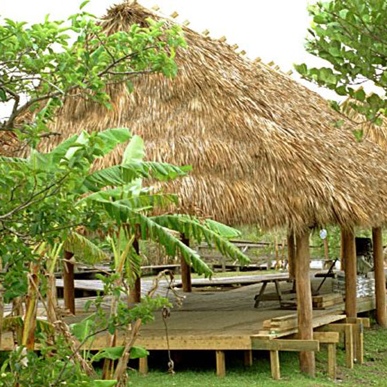
Miccosukee Photos
Gallery of Exploring Florida photos of the Miccosukee Reservation including views of Chickees and a dugout canoe. There are also a few Miccosukee Indian Village photos on the ClipPix ETC site.
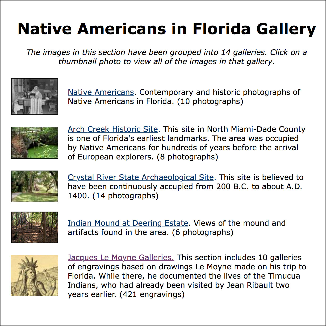
Native Americans in Florida Photos
Fourteen galleries of photos and illustrations related to Native Americans in Florida including LeMoyne’s drawing of the Timucua, the Crystal River State Archaeological Site, the mind at the Deering Estate, Lake Jackson Mounds, Letchworh Mounds, Madira Bickel Mound, Miccosukee Nation, Ortona Mound, and the Portevant Indian Mound.
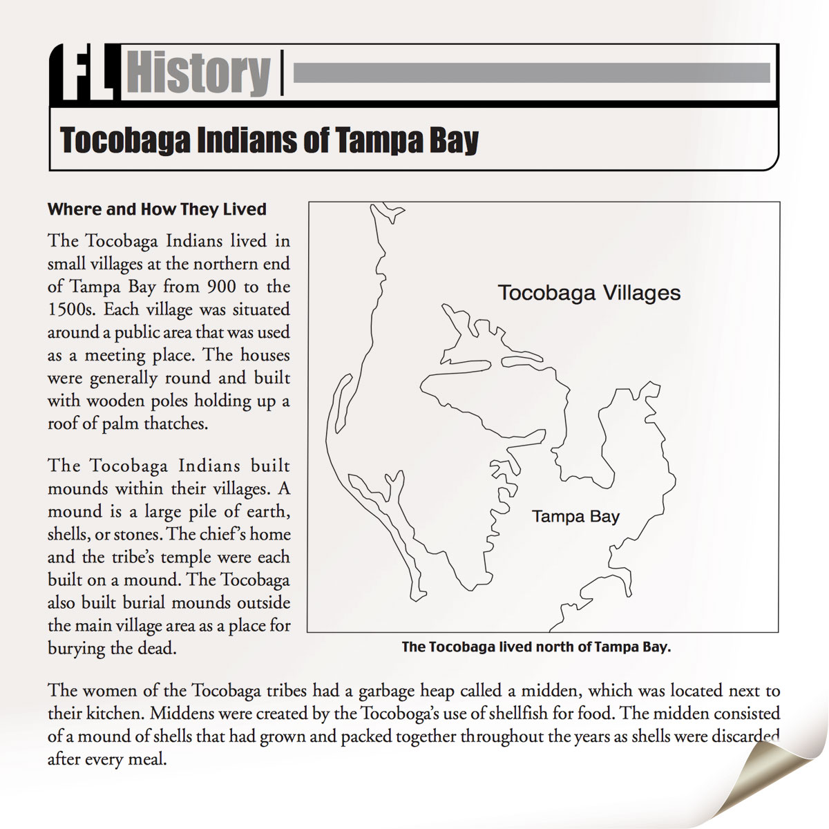
Tocobaga Indians of Tampa Bay
Two-page PDF about the Tocobaga from the Florida Then and Now section of Exploring Florida. All the passages of Florida Then and Now are written at the upper elementary level.
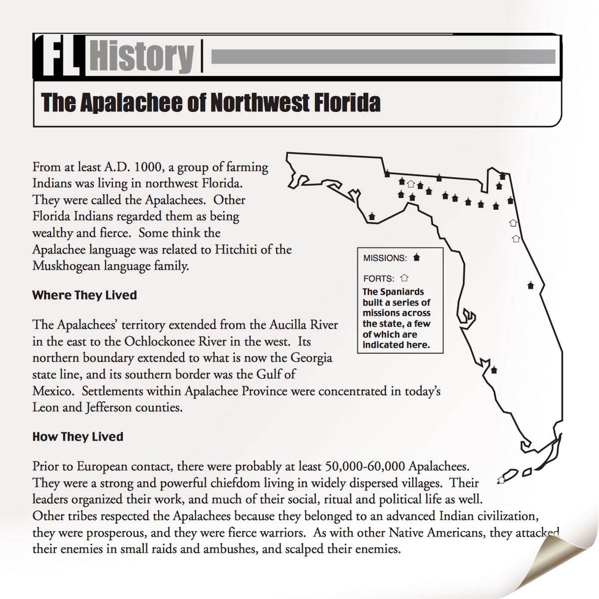
The Apalachee of Northwest Florida
Two-page PDF about the Apalachee from the Florida Then and Now section of Exploring Florida. All the passages of Florida Then and Now are written at the upper elementary level.
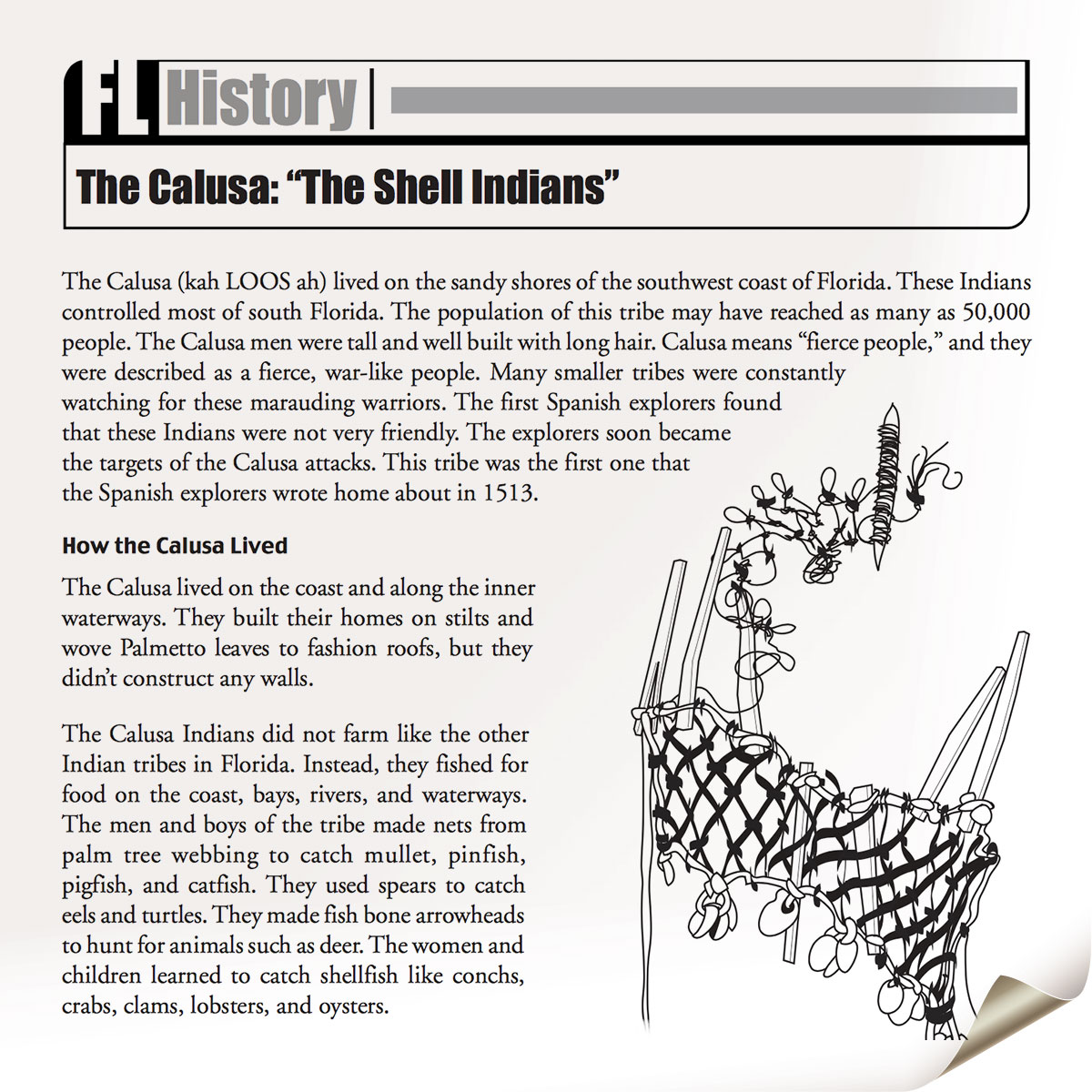
The Calusa: “The Shell Indians”
Two-page PDF about the Calusa from the Florida Then and Now section of Exploring Florida. All the passages of Florida Then and Now are written at the upper elementary level.
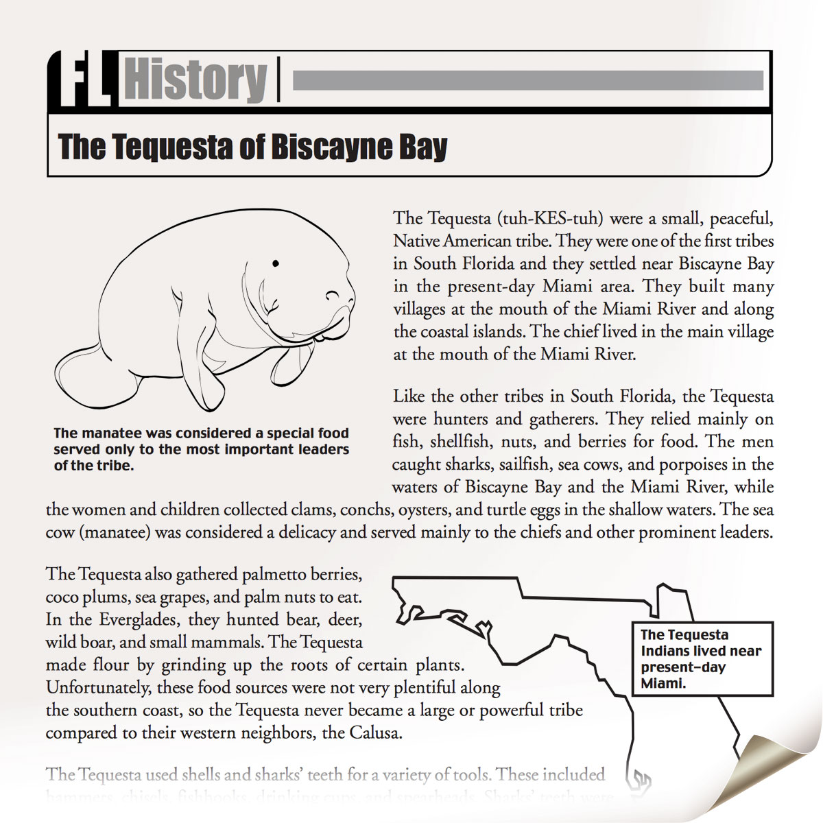
The Tequesta of Biscayne Bay
Two-page PDF about the Tequesta from the Florida Then and Now section of Exploring Florida. All the passages of Florida Then and Now are written at the upper elementary level.
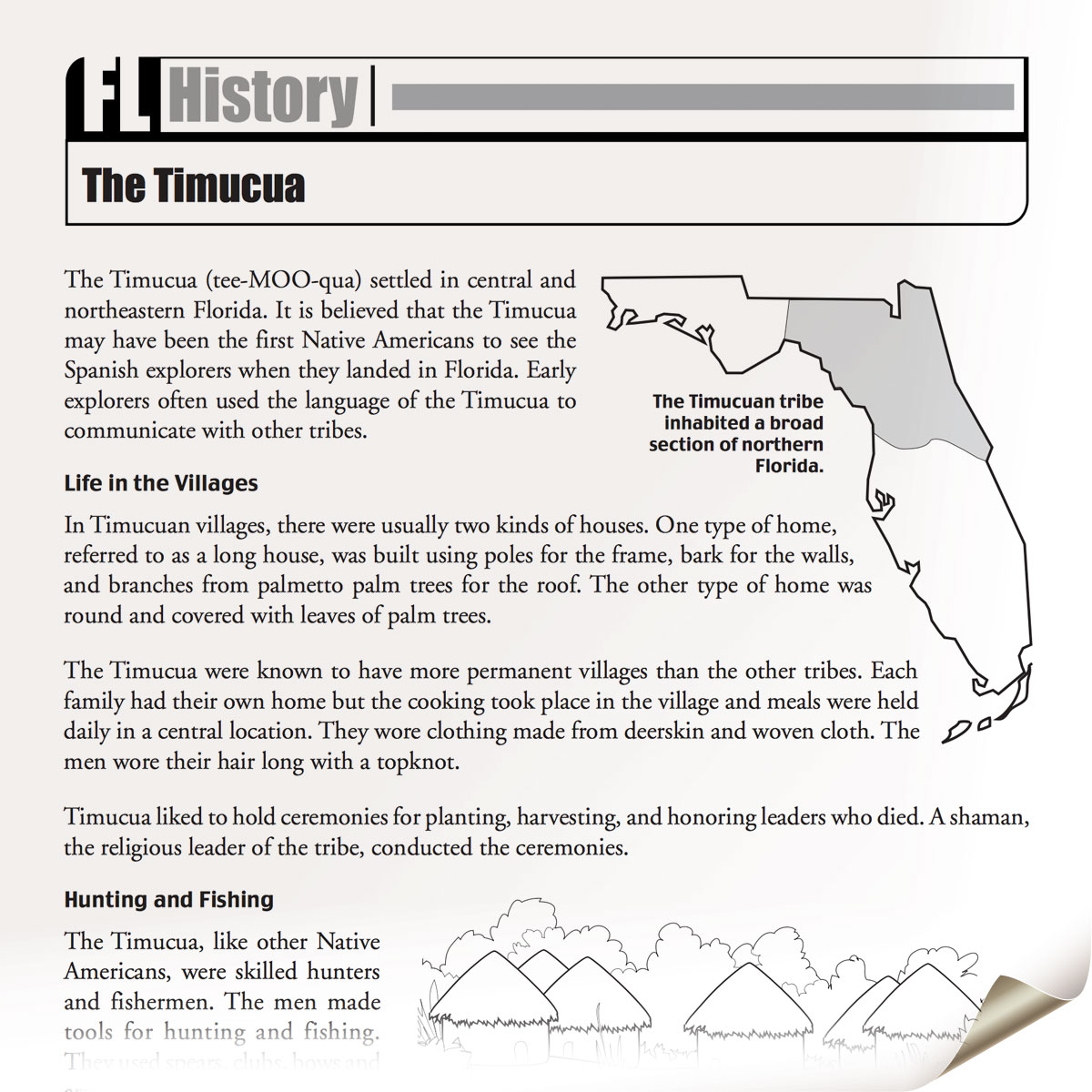
The Timucua
Two-page PDF about the Timucua from the Florida Then and Now section of Exploring Florida. All the passages of Florida Then and Now are written at the upper elementary level.
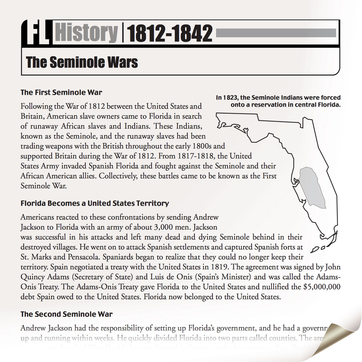
The Seminole Wars
href=”https://fcit.usf.edu/florida/lessons/sem_war/sem_war1.pdf”>Seminole Wars from the Florida Then and Now section of Exploring Florida. All the passages of Florida Then and Now are written at the upper elementary level.
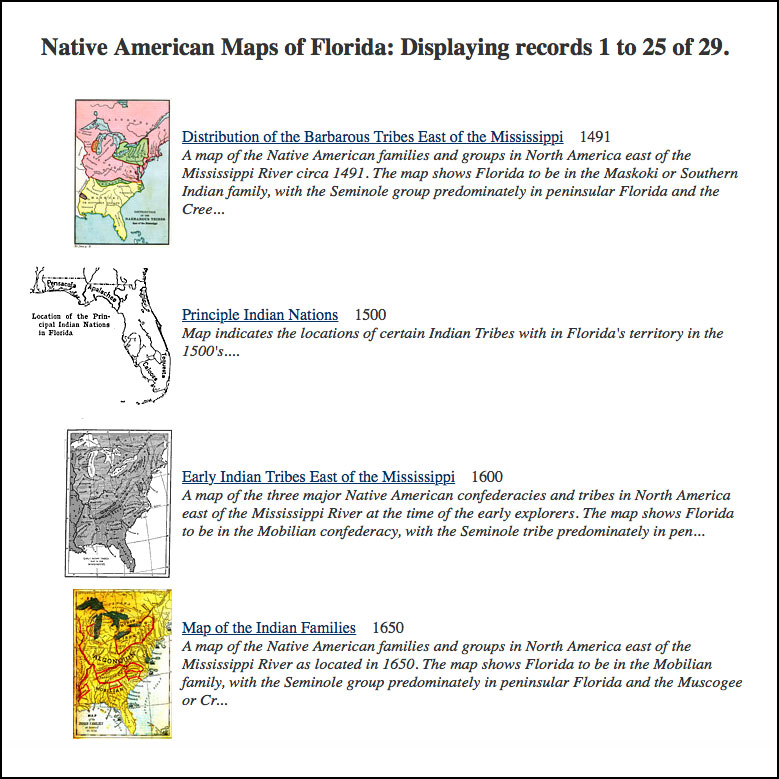
Native American Maps of Florida
Several dozen maps showing Native American locations in Florida, from the Exploring Florida website.
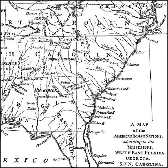
The American Indian Nations, 1776
An early map of the southeastern North America around 1776, showing the American Indian Nations of the region at the time. The map shows colonial boundaries extending from the Atlantic coast to the Mississippi River, towns, forts, and rivers.
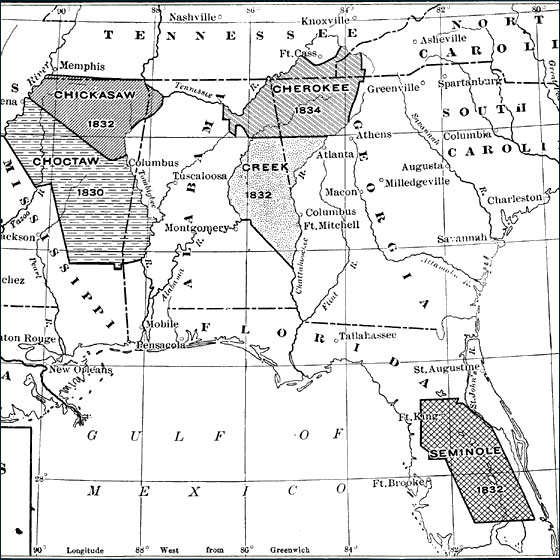
Removal of Southern Indians, 1830 to 1834
A map showing the removal of southern Native Americans including the removal of the Florida Seminoles from their reservation in 1832. The removal efforts were instrumental in the lead-up to the Second Seminole War from 1835 to 1842.
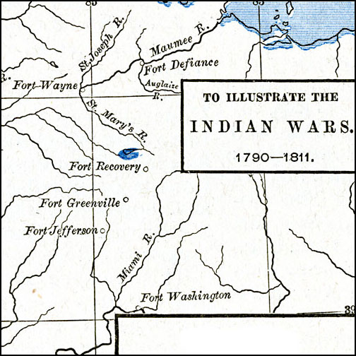
The Northwest Indian Wars, 1790–1811
A map of the area around the Wabash River showing the sites of the American Indian Wars between 1790 and 1811, including the Northwest Indian War (1785–1794) and Tecumseh’s War (1810–1811). The map shows the forts and rivers of the area, including the Maumee River, site of the Battle of Fallen Timbers near present day Toledo (August 20, 1794), and Tippecanoe River, site of the Battle of Tippecanoe near Prophetstown (November 7, 1811).

Native American Delimitations, 1763–1770
A map of the American colonies and territories west to the Mississippi River between the end of the French and Indian War of 1763 and the beginnings of westward expansion of the trans–Appalachian colony proposed in the Vandalia Project (1770), shortly before the American Revolutionary War. The map shows the proclamation line of the British colonies established in 1763 that defined the western boundary of the colonies along the watershed divide of the Appalachian Mountains, and the various delimitation lines of Native American lands established by treaties between 1763 and the Treaty of Lochaber between Britain and the Cherokee (1770).
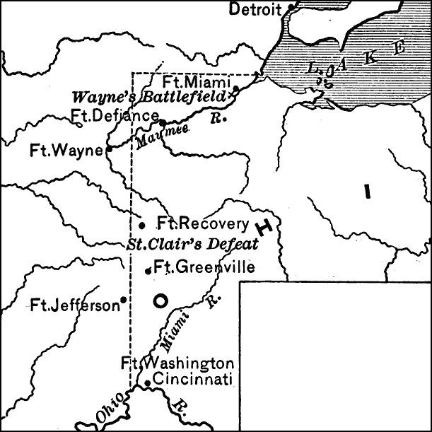
Campaign in the Northwest, 1794
A map of the area in Ohio showing General Anthony Wayne’s campaign against the Indians during the Northwest Indian War (1785–1795). The map shows the site of General Arthur St. Clair’s defeat near Fort Recovery (November 4, 1791), the sites of Fort Miami, Fort Defiance, Fort Wayne, Fort Recovery, Fort Greenville, Fort Jefferson, and Fort Washington, and the site of Wayne’s battlefield on the Maumee River, known as the Battle of Fallen Timbers (August 20, 1794), the final battle of the Northwest Indian War. From the Maps ETC website.
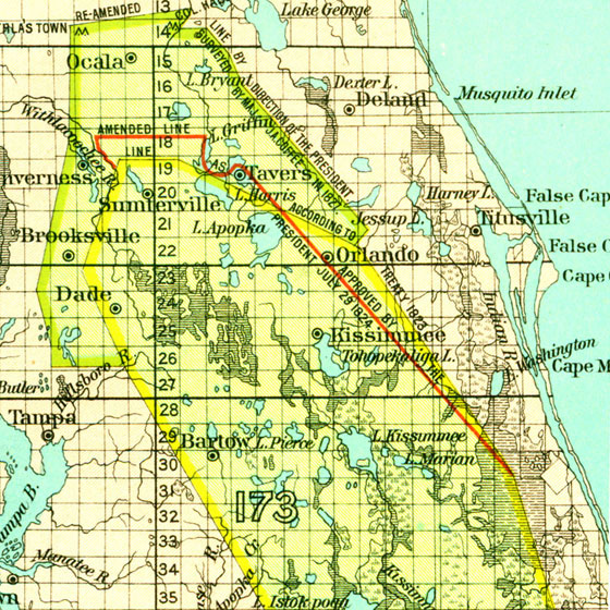
Peninsular Florida Reservation, 1824 to 1832
A map of the primary pre 1832 Native American reserve in Florida showing original treaty lines and amended reserve lines in the large peninsular reservation.
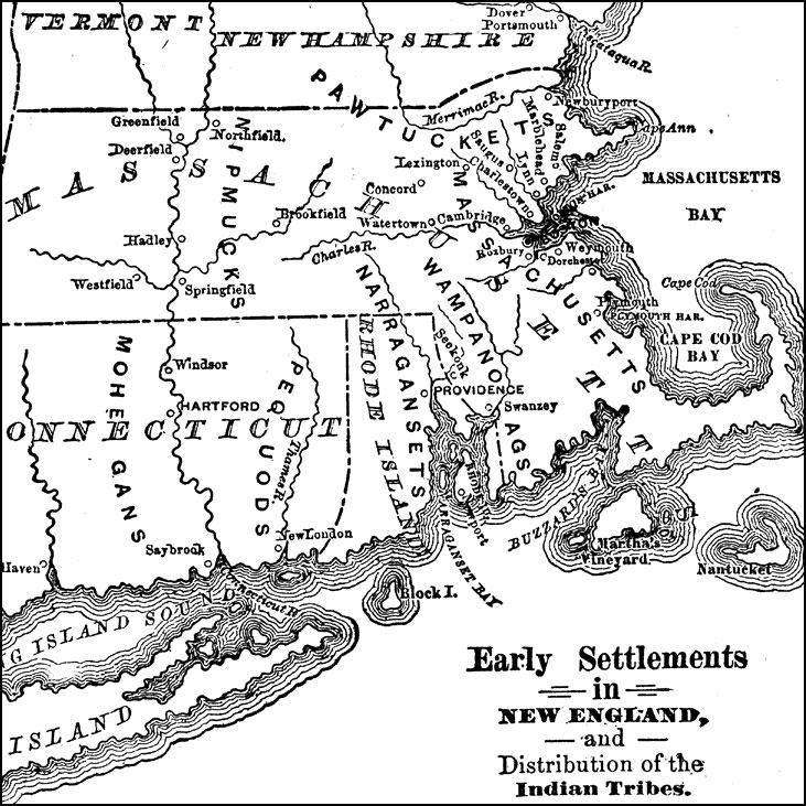
Distribution of the Indian Tribes, 1686
A map of the Dominion of New England (1686), showing the early settlements and the general tribal lands of the Pawtuckets, Massachusetts, Wampanoags, Narragansets, Nipmucks, Pequods, and Mohegans.
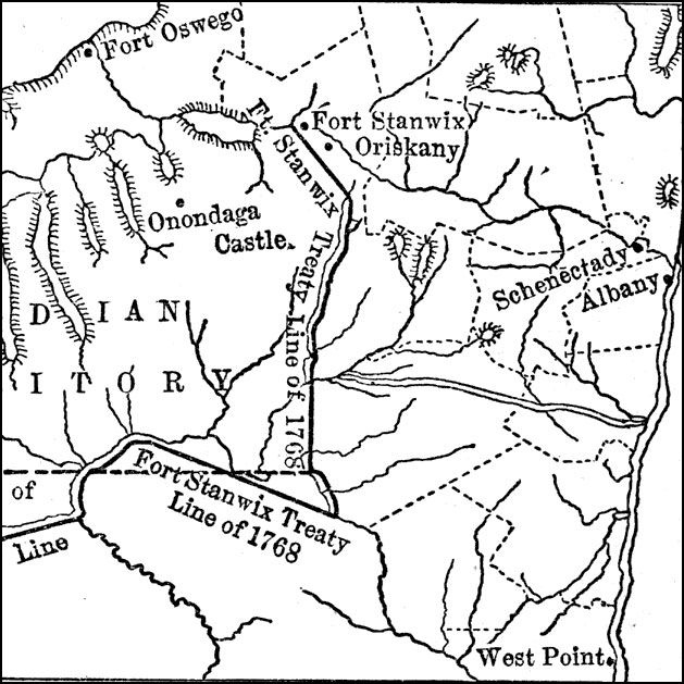
The Iroquois Country, 1768
A map of the Finger Lakes region of Upstate New York showing the Iroquois Six Nations lands as established by the Fort Stanwix treaty of 1768. The map show the expansion of English colonial settlers into the upper Hudson River Valley area, including the building of forts and the settlements of Albany, Schenectady, and Oriskany.
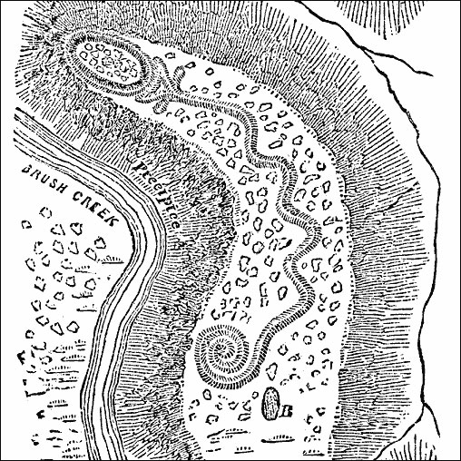
The Great Serpent Mound, 1892
A map from 1892 of an overhead view of the Great Serpent Mound, constructed along Bushy Creek by ancient Native Americans in what is now Ohio.
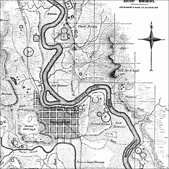
Works at Newark, Ohio, 1862
A map of the ancient Mound Builder works at Newark, Ohio, made from surveys “executed while the chief earthworks could still be traced in all their integrity.”
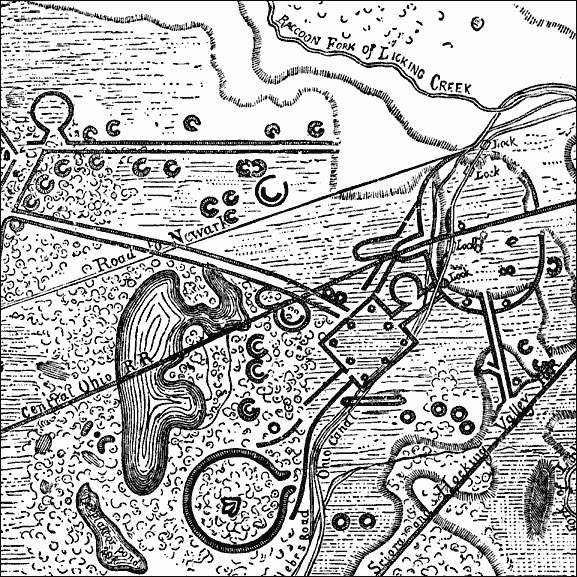
Scioto Valley, 1847
A map of a section of the Scioto Valley in south–central Ohio, in the vicinity of Chillicothe, showing the ancient monuments built by the Mound Builders of the Hopewell tradition. The letters A, B, C, etc. mark the ancient sites. Enclosures are shown by dashed lines, and the mounds are designated by small dots.
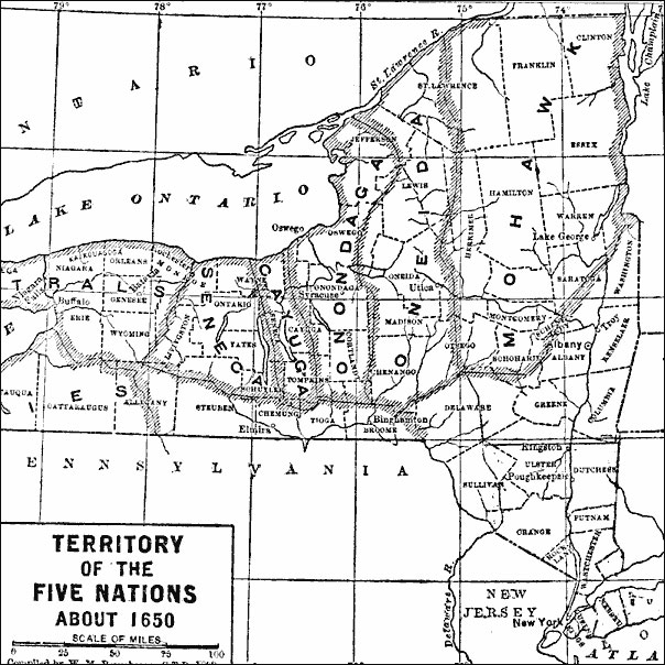
Territory of the Five Nations, 1650
A map of upper New York showing the territory of the Five Nations (Mohawk, Oneida, Onondaga, Cayuga, and Seneca) around 1650, with the territory of the Neutrals to the west.
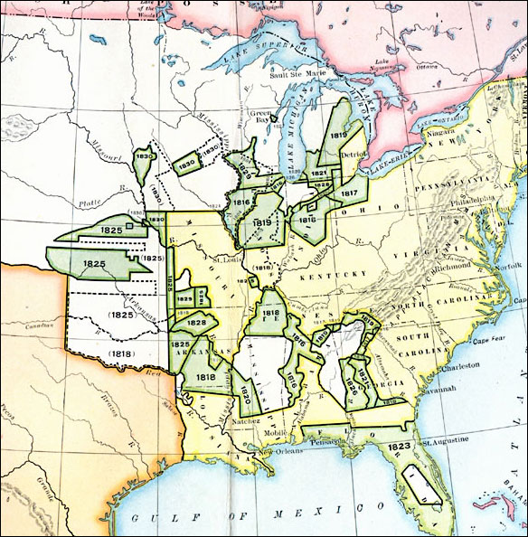
Cession of Native Lands, 1816–1830
A map of the United States showing the cession of Native American lands between 1816 and 1830. The map is color–coded to show the lands ceded prior to 1816, the lands ceded between 1816 and 1830 with dates of cession given, and areas unceded in 1830. Dotted lines show the areas of earlier cessions where a later cession by later tribes was required to complete the possession by the United States.
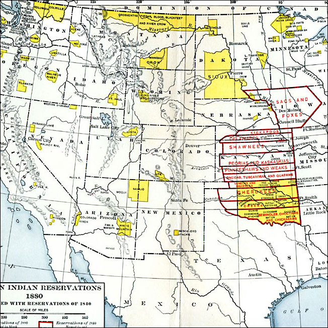
Western Reservations, 1840–1880
Native American reservations in the West, showing locations in 1840 and 1880.
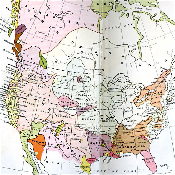
Distribution of Native Americans, 1500
A map from 1906 of North America central Canada to northern Mexico showing the distribution and territories of the Native Americans around 1500. The boundaries are based on linguistic stock and not tribal territories. “Anthropologists of to–day determine groups on one of four sets of characteristics — physical, linguistic, geographical, and general culture.
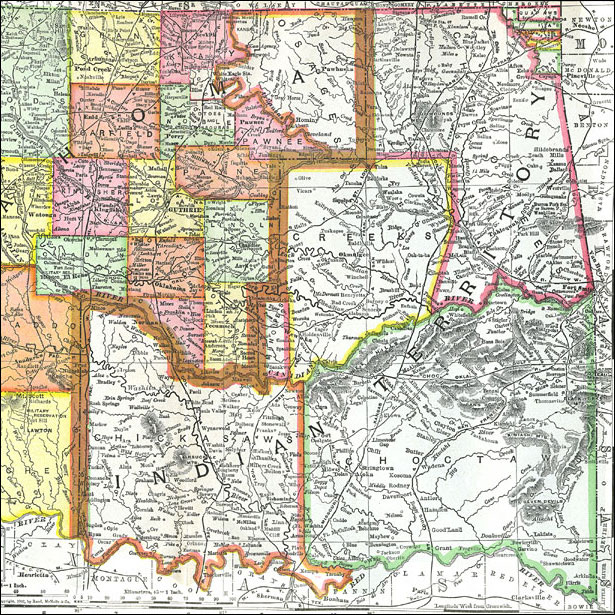
Oklahoma and Indian Territory, 1903
A map from 1903 of the Indian Territory and Oklahoma Territory prior to statehood (November 16, 1907), showing the boundary between the territories, the territorial capitals of Tahlequah (Indian Territory) and Guthrie (Oklahoma Territory), counties and tribe lands, principal cities and towns, railroads, mountains, and rivers.
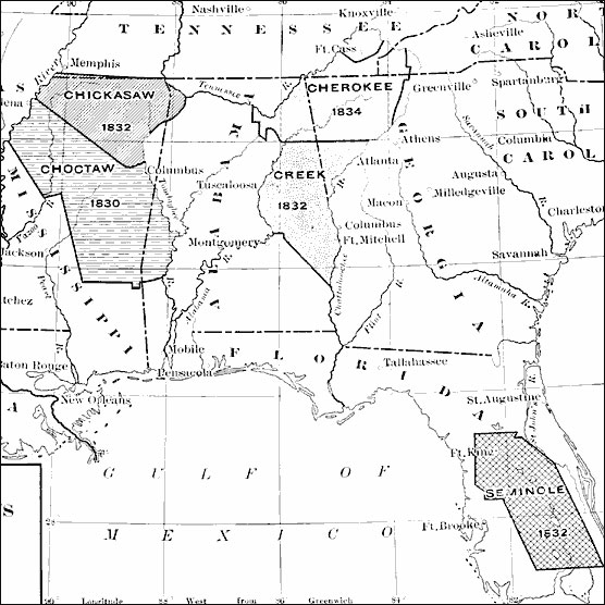
Removal of Southern Indians, 1830–1834
A map of the southeastern United States showing the lands of the Five Civilized Tribes (Cherokee, Chickasaw, Choctaw, Creek or Muscogee, and Seminole), indicating the dates of removal to Indian Territory (Oklahoma) under the Indian Removal Act of 1830. The dates include the Treaty of Dancing Rabbit Creek (Choctaw, 1830), the Federal purchase of Chickasaw lands and the forced removal of the Creek and Seminole, (1832), the Treaty of Payne’s Landing (Seminole, 1832), and the Treaty of New Echota (Cherokee, 1835).
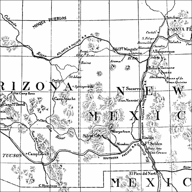
The Pueblo Region of Arizona and New Mexico, 1884
A map reproduced from the works of Adolphus F. Bandelier (Fifth Report of the Archeological Institute of America, 1884) of the Arizona and New Mexico region showing the Pueblo sites in the area.
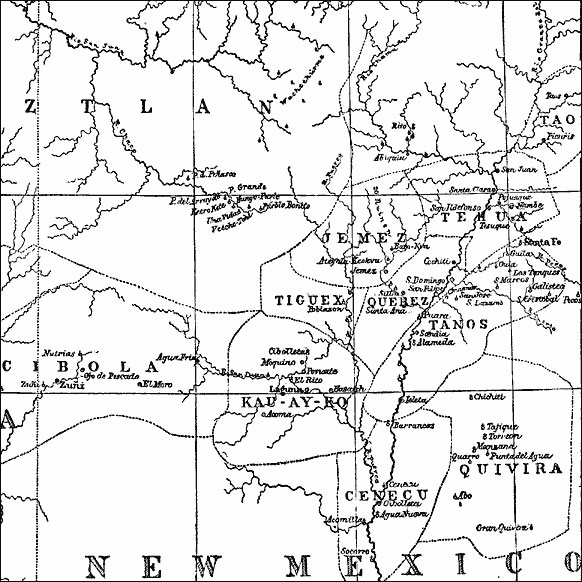
Pueblo Region of Arizona and New Mexico, 1876
The small dotted circles stand for inhabited pueblos; those with a perpendicular line attached are ruins; and when this perpendicular line is crossed it is a Mexicanized pueblo.
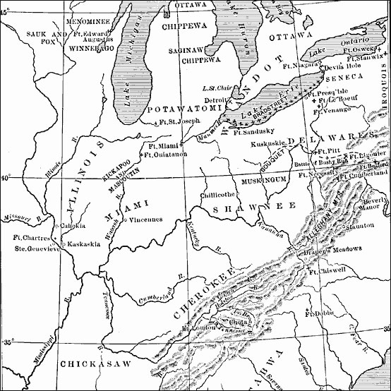
The Western Frontier and Pontiac's Rebellion, 1763
A map of eastern North America and the Northwest Territory in 1763 during Pontiac’s Rebellion at the end of the French and Indian Wars. The map shows the general tribal lands east of the Mississippi River of the Ottawa, Potawatomi, Wandot, Seneca, Iroquois, Delaware, Muskingum, Shawnee, Chippewa, Saginaw, Menominee, Sauk and Fox, Winnebago, Kickapoo and Mascoutin, Miami, Cherokee, Chickasaw, Catabwa, Choctaw, Creek, and Seminole, the French and British forts and settlements, the battle sites of Bushy Run and Devil’s Hole, and the routes of the British campaigns under John Bradstreet and Henry Bouquet.
Roy Winkelman is a 40+ year veteran teacher of students from every level kindergarten through graduate school. As the former Director of FCIT, he began the Center's focus on providing students with rich content collections from which to build their understanding. When not glued to his keyboard, Dr. Winkelman can usually be found puttering around his tomato garden in Pittsburgh. Questions about this post or suggestions for a future topic? Email me at winkelma@usf.edu. To ensure that your email is not blocked, please do not change the subject line. Thank you!
FCIT Newsletter
Each month FCIT publishes a newsletter with short articles on teaching and learning with technology, using digital content in the classroom, and technology integration. Subscribe today! The subscription form will open in a new window. When you have subscribed, you can close the new window to return to this page.