
ALERT! Not a Florida teacher? Don’t run off! You can use this collection even if your students never study or have even heard of Florida. In fact, the less your students know about Florida, the more they’ll have to rely their map reading and research skills.
One map is a valuable classroom resource. Two maps of the same area from different time periods create opportunities for even more engaging classroom activities. (See the post: Historic Florida Maps and Google Earth.) But what if you had three maps of the same area from different time periods? Or ten maps? Or fifty? Or hundreds? Well, you do.
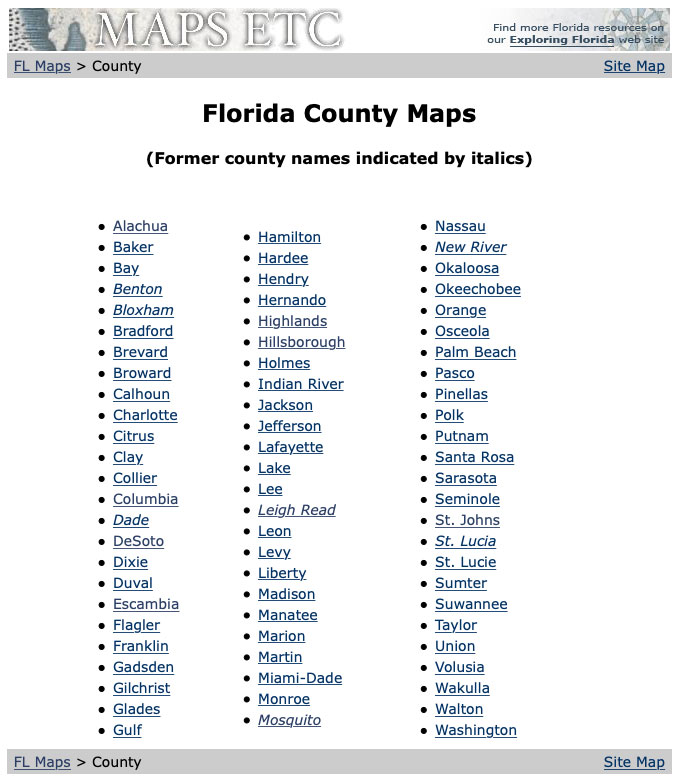
The Exploring Florida website includes a section of approximately 6,000 historic maps. Since they’re arranged by location, it’s easy to find many maps of the same region, but from different time periods. There are also separate galleries for each of Florida’s 67 counties so every student in even a large class could have his or her own collection of maps to work with.
Maps of Florida are particularly interesting because very little was known about the region when the earliest maps were made. The region was transferred among multiple countries, each of which left its mark. And Florida, of course, includes interesting coastlines and other geographic features, especially wetlands that were once seen as “problems” to overcome.
I’ve created a starter list of questions you might want to pick from depending on whether you want classroom activities to focus on political history, cultural history, global connections, technology, economics, or other areas:
- Why do cities grow where they do?
- What man-made changes can be seen on the maps? (canals, filled or drained wetlands, dredging)
- How have shorelines naturally changed?
- How do names of new counties reflect the history of the times?
- How much information did the mapmaker actually have about the area represented?
- Why were huge land grants made to railroad companies? Why are railroad grants shown as checkerboards?
- Why were forts and other military installations located where they were?
- How does available transportation effect where people settle?
- Which maps in the series were created for a specific purpose? For example, to encourage settlement or travel.
- What evidences of the Township and Range Survey are visible on the maps? Why?
- How are political boundaries formed? Which county boundaries follow rivers? Which are arbitrary?
- Can you find any physical features that are simply in the wrong place on the older maps?
- How do lakes, rivers, and wetlands effect development?
- Are there areas where development was influenced by Spanish land grants or Native American reservations?
- Why did Florida start out with only 2 counties, but end up with 67?
- Can you find geographic features that were poorly understood on early maps, but better represented on later maps?
- Where and when were areas identified as unsurveyed, or partly surveyed or partly sectioned?
- Are there any imaginary features on the older maps that were just made up by the mapmaker?
- Can you find places, cities, and even entire counties that were renamed? Why would they be renamed?
The two best choices for locating a large number of maps from the same area are the site’s collection of maps of the entire state and the individual county map collections.
Maps of the Entire State
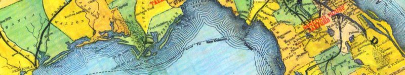
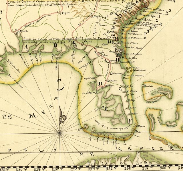
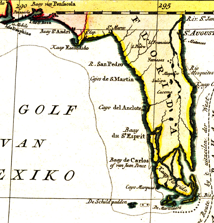
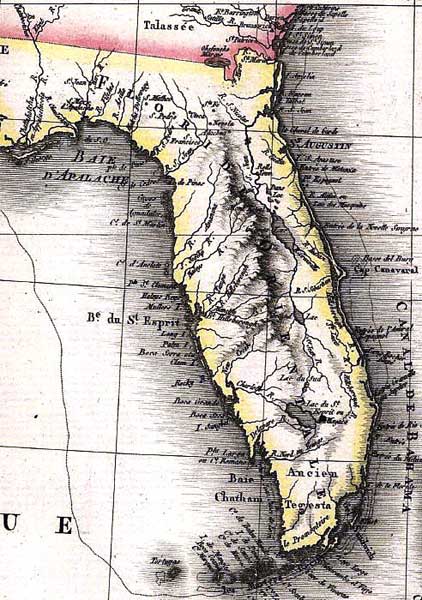
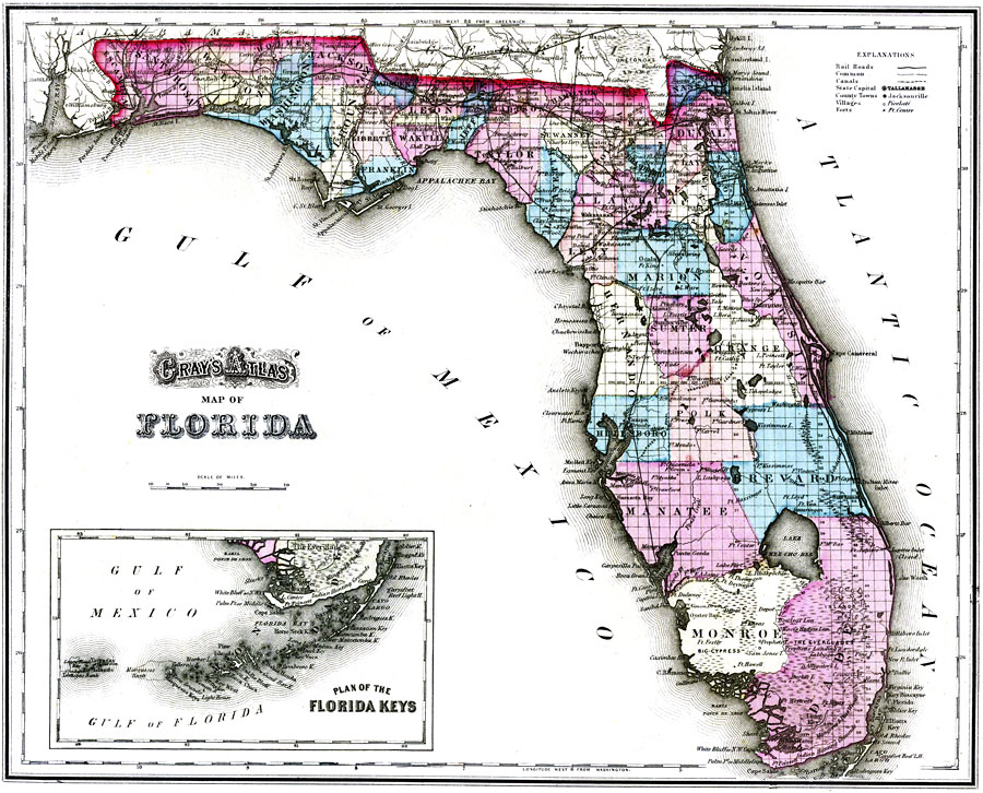
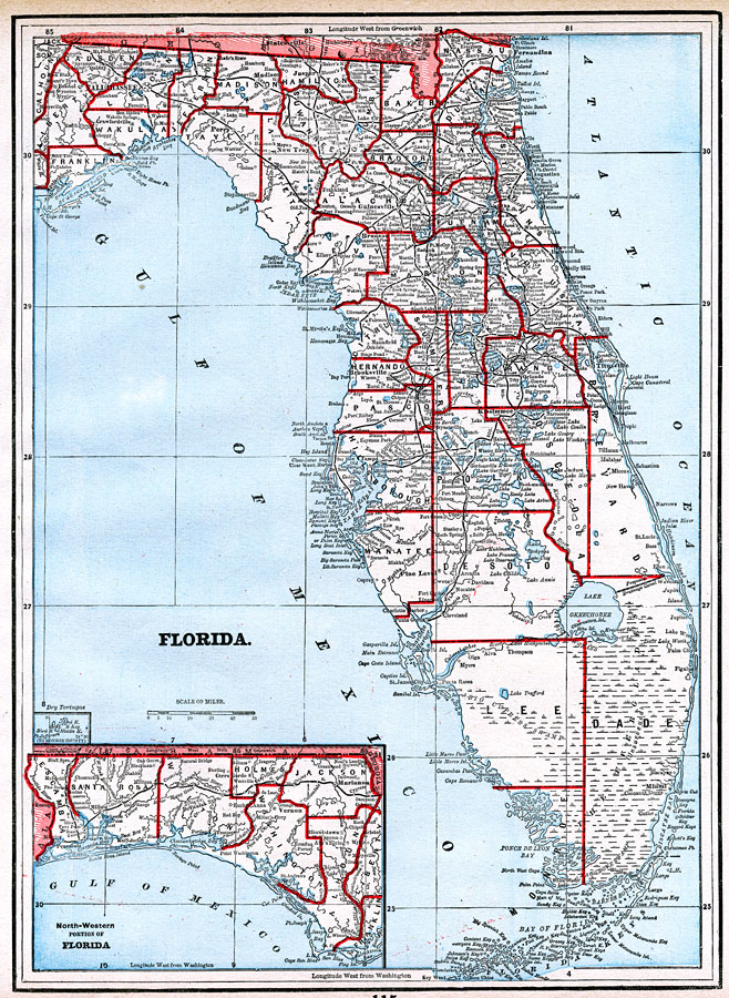
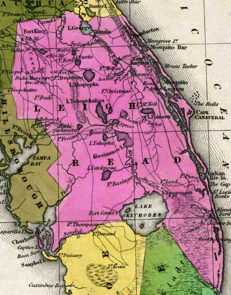
Exploring Florida includes about 400 different maps of the entire state. They are presented in chronological order. Each map will include a description, source, and other information as known. Many of the maps will also include both color and black-and-white PDFs which can be printed for student activities or display. Many of the maps with great detail will also be available in a “Zoomify” version, which will allow you to move around within the map and zoom into any area to better see smaller details.
Here are just a few samples of the available state maps. Select any thumbnail to open in lightbox.
County Maps
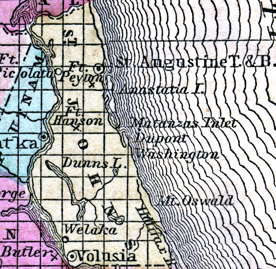
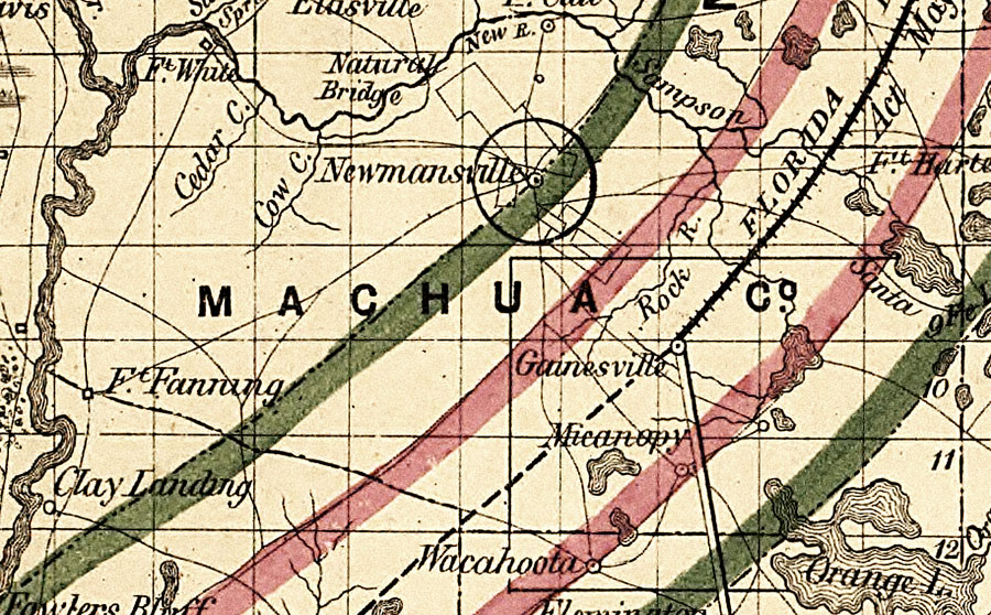
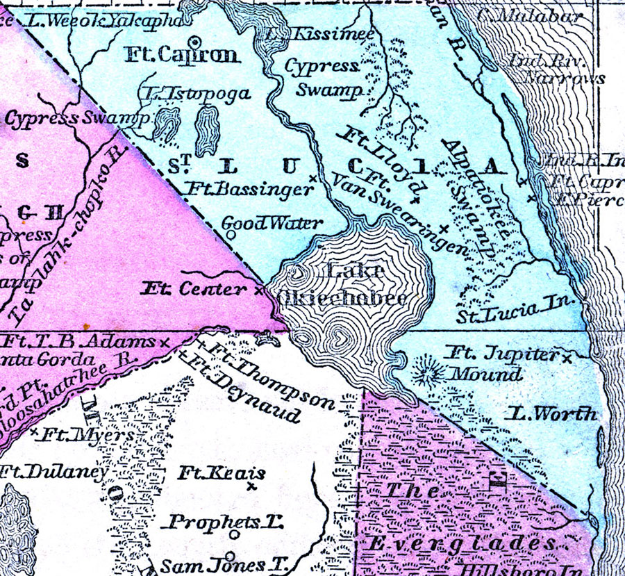
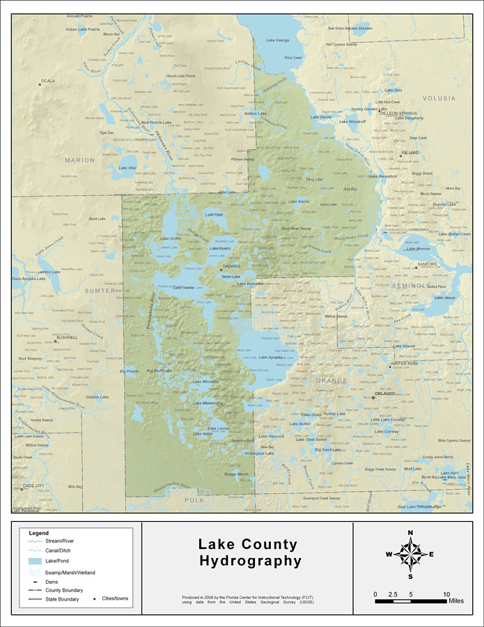
You’ll also find 60, 70, or more maps for each of Florida’s 67 counties. As with the state maps, they are arranged in alphabetical order. The first two counties (Escambia and St. Johns) were established in 1821. As Florida became more populated, the counties were divided into smaller areas. The last county created was Gilchrist in 1925. At the top of each gallery of county maps, you’ll find a short history explaining the formation of the county. There will also be links to the county from which it was formed, so students can work their way backwards to earlier maps of the same region. Toward the end of each set of maps, you’ll find some contemporary county maps created by FCIT. These include transportation networks, sinkholes, waterways, and hydrography.
Here are just a few samples of the available county maps. Select any thumbnail to open in lightbox.
If you students want to view particular areas within a county, there’s also an extensive collection of local maps sorted by county. Most of the local maps are from the US Geological Survey and the State Road Department.
Please let me know how you’ve been able to use the Florida map collection in your teaching. We put several years of effort into creating this resource and enjoy hearing from our users.
Roy Winkelman is a 40+ year veteran teacher of students from every level kindergarten through graduate school. As the former Director of FCIT, he began the Center's focus on providing students with rich content collections from which to build their understanding. When not glued to his keyboard, Dr. Winkelman can usually be found puttering around his tomato garden in Pittsburgh. Questions about this post or suggestions for a future topic? Email me at winkelma@usf.edu. To ensure that your email is not blocked, please do not change the subject line. Thank you!
FCIT Newsletter
Each month FCIT publishes a newsletter with short articles on teaching and learning with technology, using digital content in the classroom, and technology integration. Subscribe today! The subscription form will open in a new window. When you have subscribed, you can close the new window to return to this page.