Maps Site map
  FL Maps > Region > 1880-1899
Site Map  

  Record   1   to   25  of   36

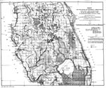
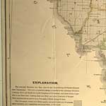
Survey for the opening of steamboat communication from Saint John's River, Fla., 1881
Digitization provided by the USF Libraries Digitization Center. Rare Maps. This is a hand colored map of the opening of steamboat communication from the St. Johns River to Charlotte Harbor western section by way of Tohopokeliga Lake circa 1881. There...

Survey for the opening of steamboat communication from Saint John's River, Fla., 1881
Digitization provided by the USF Libraries Digitization Center. Rare Maps. This is a hand colored map of the opening of steamboat communication from the St. Johns River to Charlotte Harbor eastern section by way of Tohopokeliga Lake circa 1881. Ther...

Steamboat communication from Saint John's River, Fla., by way of Tohopokeliga Lake, to Charlotte Harbor or Peace Creek, 1882
Digitization provided by the USF Libraries Digitization Center. Rare Maps. This map covers central peninsular Florida between Sanford and Charlotte Harbor. The map shows various proposed steamship routes between the train depot on Lake Tohopokeliga t...

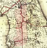
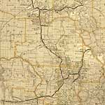
Detail - Maps showing the Florida Transit and Peninsula Rail Road and its connections, 1882
This detail from Colton's map covers central Florida and indicates drainage, cities and towns, township and county boundaries, railroads, and the 15-mile railroad land grant limits surrounding the track in central Florida. The detail shows existing t...

Section of Basin of Lake Okeechobee, 1884
This is a map showing a section of the Lake Okeechobee summit level, circa 1884. It shows water depth along the Lake Okeechobee Summit Level....

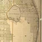
Map of the South Florida Overflowed & Swamp Lands, 1884
Map of the southern portion of Florida dealing with the overflow of water from Lake Okeechobee. Includes railroads and a few towns pertinent to the issue, as well as the lakes and rivers. Also included are two proposed canals extending east from La...

Map of Okeechobee Drainage Canal, 1884
Map of the area between Lake Okeechobee and the Atlantic Ocean showing the proposed canal to connect Lake Okeechobee to the St. Lucea River. Proposed canal is 120 feet wide and 10 feet deep and begins at Cahoney Bay in Okeechobee. Area divided into...

Charlotte Harbor and the Valley of the Caloosahatchee, 1884
Map of the Caloosahatchee River Valley. Includes a proposed canal connecting Lake Okeechobee to the Caloosahatchee River via Lake Hiokpochee, now called Hicpochee. Shading indicates areas of swamp and Everglades as well as overflowed lands. Area d...

Vicinity of Jacksonville and St. Johns River, Florida, 1886
An inset map of the vicinity of Jacksonville and the St. Johns River including Fernandina and much of Nassau County south to Lake George in Marion and Volusia counties. The map shows major cities, roads, railroads, inland waters, etc. Township and ra...

A new sectional map of Florida, 1888
This map shows county lines and county seats current to the period, major towns and cities, and railroad routes and stations. The Township and Range survey grid is shown extending from the Tallahassee Base Line and the Tallahassee Meridian. The Towns...

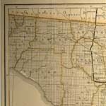
Detail - A new sectional map of Florida, 1888
This detail of a 1888 map shows county lines and county seats current to the period, major towns and cities, and railroad routes and stations. Detailed view includes Jefferson, Madison, Taylor, Hamilton, Suwannee, and Lafayette counties. The detail s...

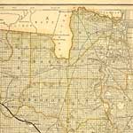
Detail - A new sectional map of Florida, 1888
This detail of a 1888 map shows county lines and county seats current to the period, major towns and cities, and railroad routes and stations. Detailed view includes Columbia, Bradford, Nassau, Duval, Clay, and surrounding counties. The Township and ...

Detail - A new sectional map of Florida, 1888
This detail of a 1888 map shows county lines and county seats current to the period, major towns and cities, and railroad routes and stations. Detailed view of parts of Lafayette and Levy counties. The Township and Range survey grid is shown extendin...

Detail - A new sectional map of Florida, 1888
This detail of a 1888 map shows county lines and county seats current to the period, major towns and cities, and railroad routes and stations. Detailed view includes Marion, Citrus, and parts of surrounding counties. The Township and Range survey gri...

Detail - A new sectional map of Florida, 1888
This detail of a 1888 map shows county lines and county seats current to the period, major towns and cities, and railroad routes and stations. Detailed view includes parts of Volusia and surrounding counties. The Township and Range survey grid is sho...

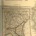
Detail - A new sectional map of Florida, 1888
This detail of a 1888 map shows major towns and cities, and railroad routes and stations. Detailed view includes an insert map of Georgia showing rail routes into Florida. ...

Detail - A new sectional map of Florida, 1888
This detail of a 1888 map shows county lines and county seats current to the period, major towns and cities, and railroad routes and stations. Detailed view includes Pasco, Hillsborough, Polk, and parts of surrounding counties. The Township and Range...

Detail - A new sectional map of Florida, 1888
This detail of a 1888 map shows county lines and county seats current to the period, major towns and cities. Detailed view includes parts of Osceola, Brevard, and surrounding counties. The Township and Range survey grid is shown extending from the Ta...

Detail - A new sectional map of Florida, 1888
This detail of a 1888 map is an inset showing major towns and cities, and railroad routes and stations. Connection to steamship lines to New Orleans and Key West are shown from Punta Gorda on the Charlotte Harbor....

Detail - A new sectional map of Florida, 1888
This detail of a 1888 map shows county lines and county seats current to the period, major towns and cities, and railroad routes and stations. This detail also shows connecting steamship lines to New Orleans and Key West. Detailed view includes parts...

Detail - A new sectional map of Florida, 1888
This detail of a 1888 map shows county lines and county seats current to the period, with major towns and cities. Detailed view includes Lake Okeechhhobee, and parts of Dade and surrounding counties. The Township and Range survey grid is shown extend...

Detail - A new sectional map of Florida, 1888
This detail of a 1888 map shows county lines and county seats current to the period, with major towns and cities. Detailed view includes parts of Monroe and Dade counties. The Township and Range survey grid is shown extending from the Tallahassee Bas...

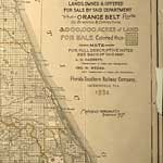
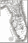
Florida Detail - New and correct map of the Chicago, Kansas & Nebraska Railway, 1888
This detail of a 1888 Railroad map shows major cities, railroad routes, and railroad stations in peninsular Florida, and includes steamship connection from Tampa to Key West and Havana, Cuba. Relief shown by hachures....

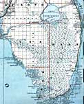
The Everglades, 1889
A portion of Bradley s commercial map of Florida detailing the southern tip of the peninsula and the Everglades. County lines and the township/range survey grid are shown. Note that much of the Everglades in Dade County were unsurveyed at the print...

Detail - Florida, 1889
Detail from the 1899 Bradley's Atlas showing the northwestern portion of the Florida panhandle, with counties, railroads, cities, inland waters, etc. Includes Township and Range grid. Digitization provided by the USF Libraries Digitization Center. Ra...

Next Last


  FL Maps > Region > 1880-1899
Site Map  

Maps ETC is a part of the Educational Technology Clearinghouse
Produced by the Florida Center for Instructional Technology © 2007
College of Education , University of South Florida